Tarquin and KB in total unison

Desolation Sound, British Columbia, Canada 2014

By
Ken Burton

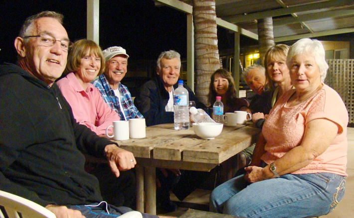
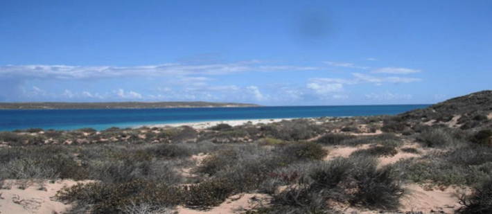
In early September 2014 a group of three intrepid paddlers met up on Salt Spring Island, BC, Canada to plan a sea kayak voyage in the Desolation Sound area.

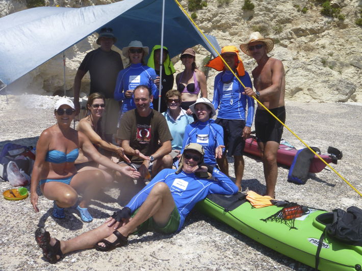
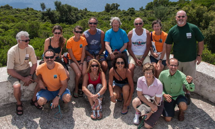
The participants were:

Tarquin – Perth born adventurer, outdoorsman, scholar, conversationalist, sociologist and dog lover living on Salt Spring Island, BC. And the ‘local’ intelligence for this trip!

David – Aussie living 6 months on Salt Spring Island and 6 months in Emerald Queensland. Leading Canadian and Australian crop-dusting pilot with a serious sense of adventure.

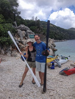
Ken (KB) – retiree, adventurer and all round good guy who decided to plan and complete a Canadian sea kayak trip after many epic trips in the North and South of WA.

David, Tarquin and KB start their adventure from Okeover Inlet

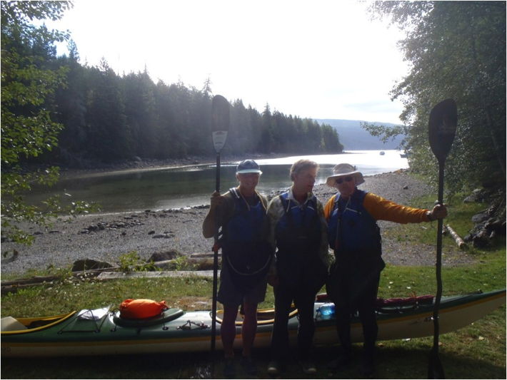
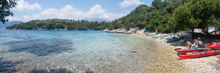
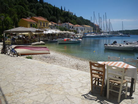
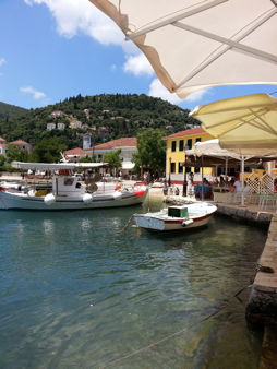
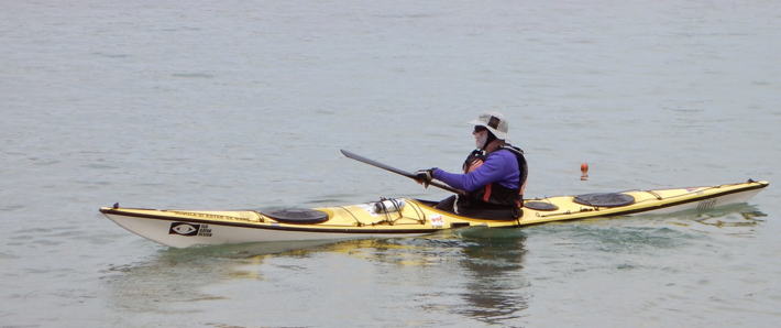
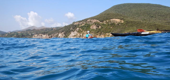
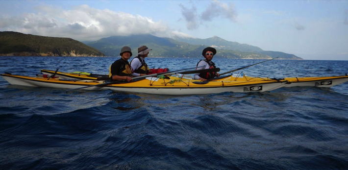
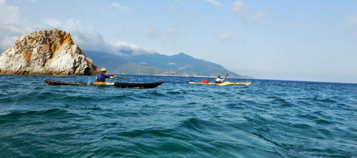
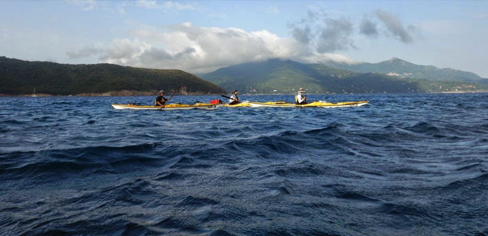
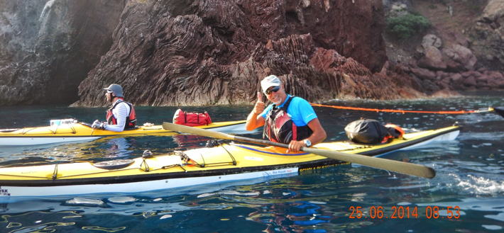
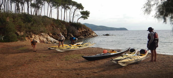
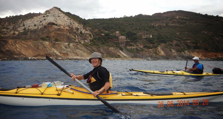
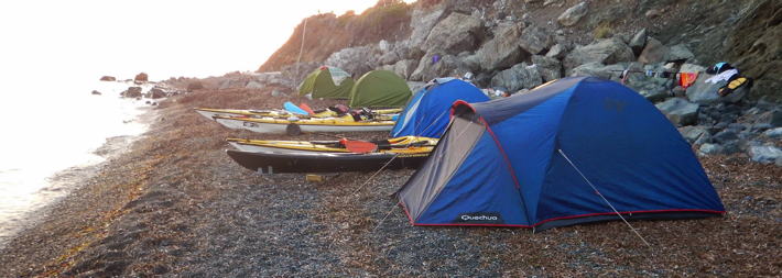
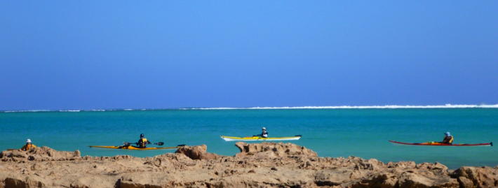
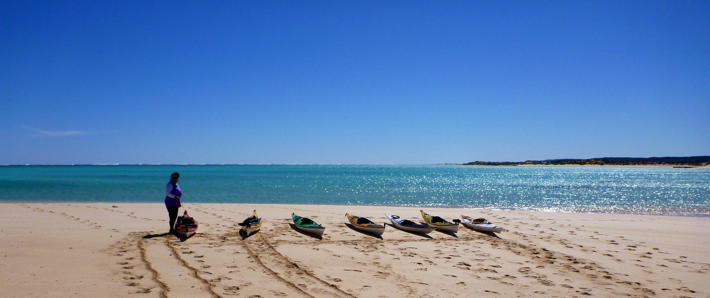
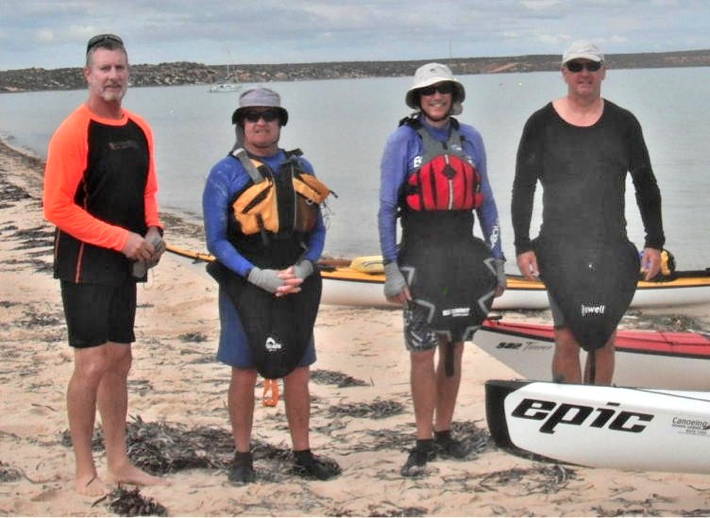
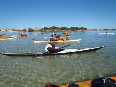
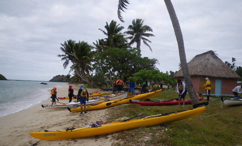
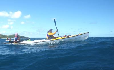
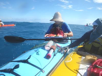
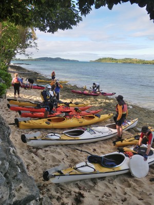
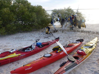
The trip to our start point at Okeover Inlet required a couple of vehicle and ferry trips from Salt Spring Island (our base), across to Vancouver Island and then a 2 hour drive north and ferry to the town of Lund.  We checked out the kayak and camping equipment hire location and were a little unimpressed with the hire fleet. After finalising our requirements for tomorrow’s start we retired to the Lund Heritage Hotel for a very good meal and a few quiet drinks. We were very excited and looking forward to the next 8 days in the sea kayaks. Our chosen kayaks were Nigel Foster designed “Seaward’s”; one double @ 37 kilograms and one single @ 28 kilograms.  We decided to swap between the double and single with Tarquin taking the single on day one.

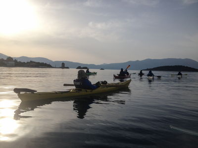
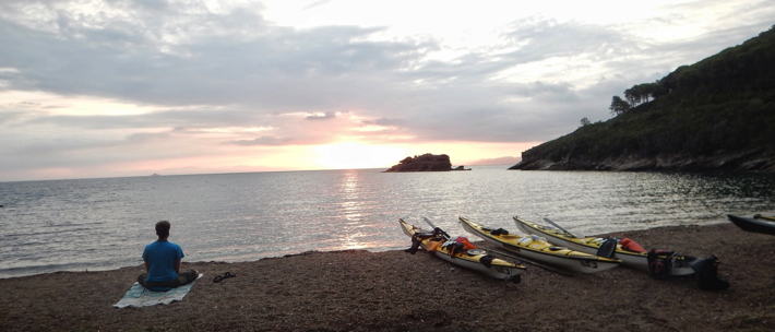
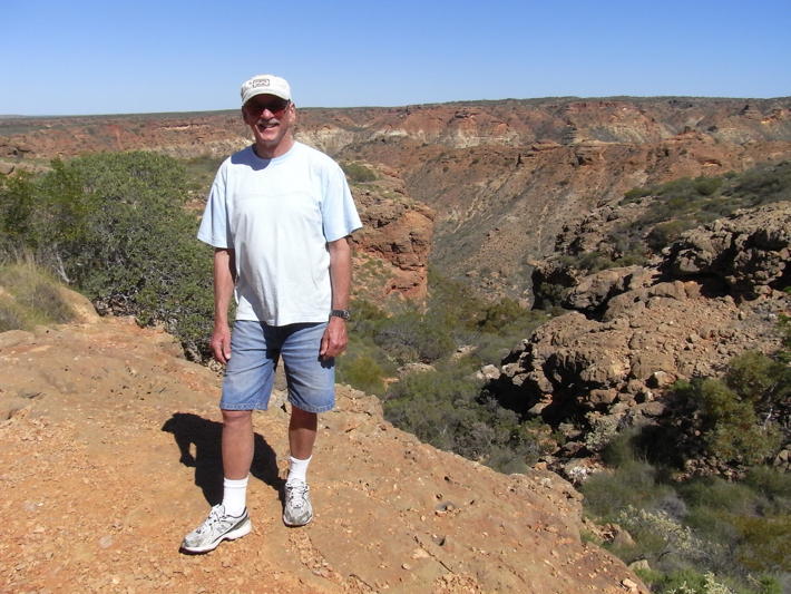
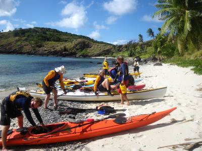
After rising for a sensational Gluten Free {GF} breakfast at Nancy’s Bakery we loaded the Landrover with our gear for the short drive to our starting point at Okeover Inlet. After getting the boats down to the muddy and rocky low tide mark we loaded up the two boats with all our gear including 60 litres of water between the three of us. The gear fitted in the hatches with little to spare and at 0945 we took the mandatory picture and started our paddle.

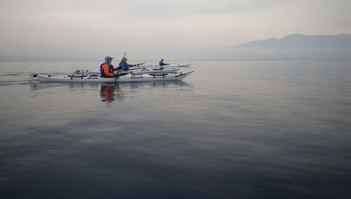
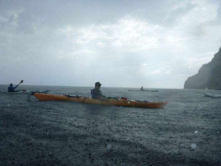
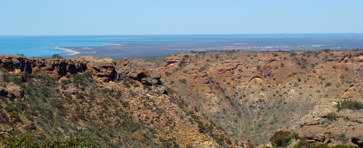
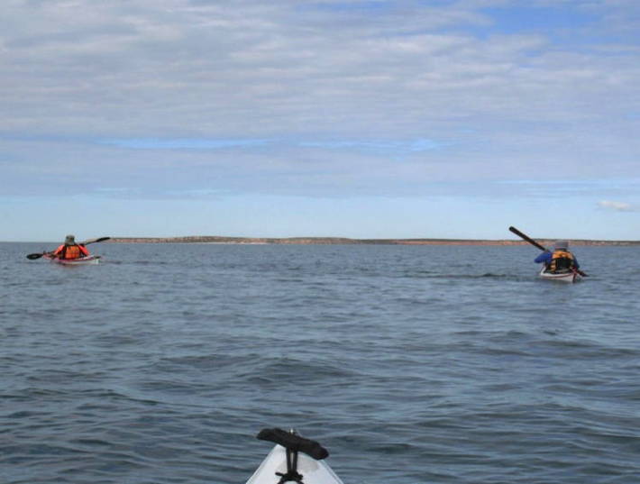
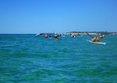
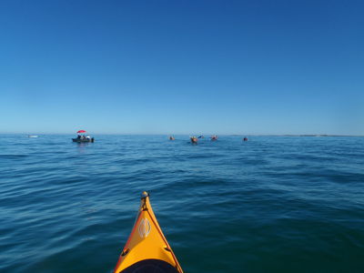
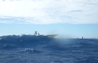
Day one was about 24 kilometres via Zephine Head (the entrance to Desolation Sound) to Portage Cove and then onto Tenedos Bay campsite close to a large freshwater lake (Lake Unwin). It took some time to get used to the fully laden boats and at about 1100 we were rounding Zephine Head when confronted by a full ‘incoming tide’. We made little headway for the next 1.5 hours as we battled the strong tide. We then decided to land on a sand quay for a quick lunch stop. After about 30 minutes we had to move on as the tide was almost covering the quay. The tide had now almost completed its inward journey and we were able to start making significant progress towards our overnight camp site.

Okeover
Leaving Okeover Inlet with view towards Zephine Head

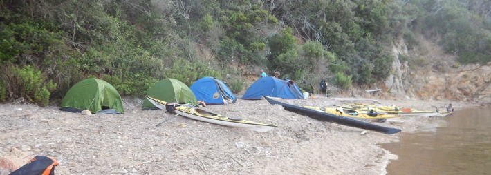
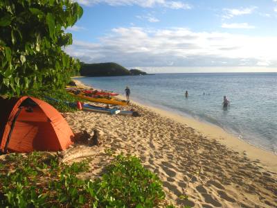
We passed between Mink Island and the Gifford Peninsula and headed on the ebb tide towards the Tenedos campsite. We arrived at the campsite at 1500 hours after a very vigorous paddle for day one! We were pleased to be able to stretch our legs and pick out a nice camp site to erect our MSR 3-man tent which by the way was superb and very easy to put up and take down.

Camp
Leaving Okeover Inlet with view towards Zephine Head

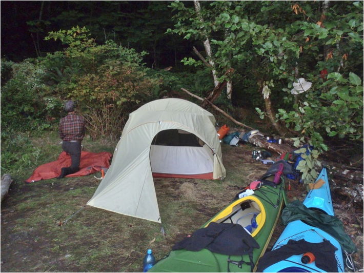
There were four sites for camping and only one was being used by a lone paddler in a “TRAK” fold up kayak. We then commenced cooking our first meal and it was very good. David and Tarquin had brought along fresh vegetables, a huge container of olives, cheese, salami, noodles, GF breads and crackers and so the scene was set for ‘dinner’ with every night being preceded with snacks before the main meal. We had tirelessly packed each meal and placed in plastic bags prior to leaving Salt Spring Island so everything was well planned. We had pasta and rice and KB promised fresh salmon so everything was set for a great paddle with good food.

Tarquin and David (being the experienced locals) then advised that we have to be careful of bears and cougars and that all food must be hauled up into the trees away from our tent so these dangerous animals would not cause us any problems. We had purchased a can of “Bear Spray” that according to the manufacturer would deter bears if you followed the instructions! The instructions were…”If a bear approaches take safety catch off, aim directly at the bears nose, wait until the bear is within 15 feet and then press button” …Yeah right!  We kept the bear spray in the tent with us but in reality I doubt if it would have helped us in the event we were attacked by a bear. That night and subsequent nights we set a rope between large trees and pulled all the food bags to a height of 4 metres immediately after dinner. It was a ‘pain’ but necessary!

We all snored somewhat during that first night and ‘ribbed’ and criticised each other and for some reason, from then on, the snoring stopped for the rest of the trip!

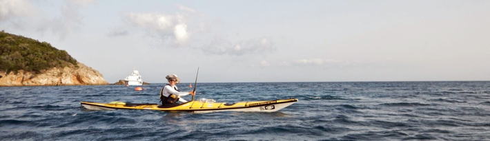
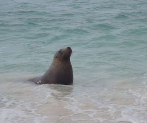
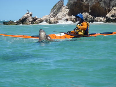
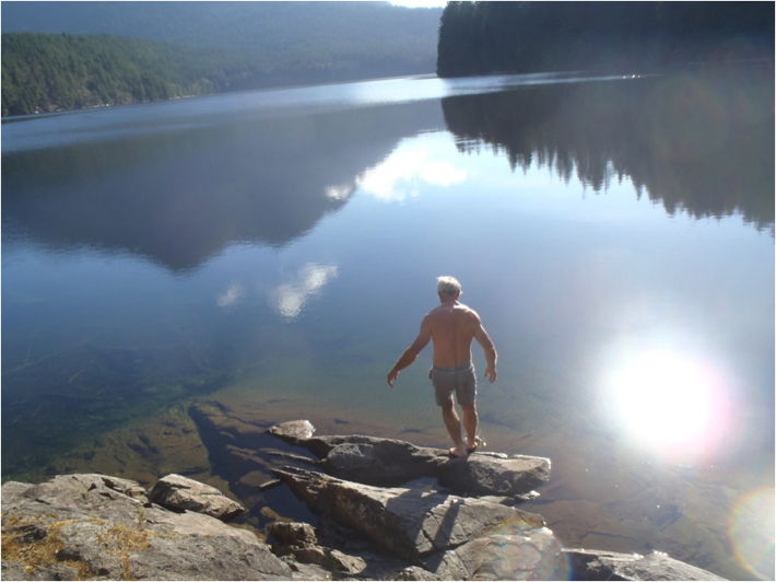
Perfect sunny weather greeted us on day two. It was decided that as day one was a little tiring that we would do some hiking to Lake Unwin for a swim and enjoy a small day paddle of about 8 kilometres to Mink Island in the afternoon and utilise the same campsite as day one. After the swim KB decided to return to the campsite by himself and duly got geographically embarrassed for some 2 hours – the Northern Hemisphere proved difficult for him to get his bearings correct! After a bit of Aussie ribbing we  set off on our short afternoon paddle accompanied by what seemed like dozens of dolphins and seals also delighting in the Indianesque summers day.

Lake
David about to dive into Lake Unwin

Another healthy GF dinner was prepared by Tarquin and David with fresh vegetables, including kale, tomatoes and carrots. We were using about 4 litres of water per day each and although water was not readily available we had spoken to some boaties who had agreed to donate water if we needed it. As it was summer the waterways and anchorages seemed to have a few boats at each location so we were confident that the water situation would be OK.

That night we shared conversation with the solo paddler and found out that he had been on the water for 2 weeks around Desolation Sound and was heading back over the next three days. We retired at about 2000 hours and all slept pretty well except for the mandatory toilet visit during the night – when one person woke we all woke!

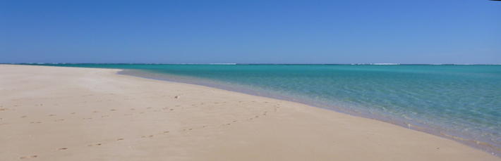
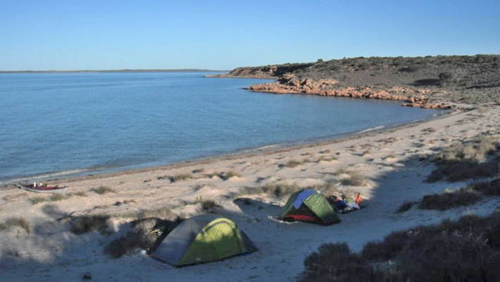
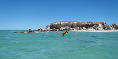
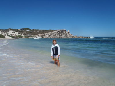
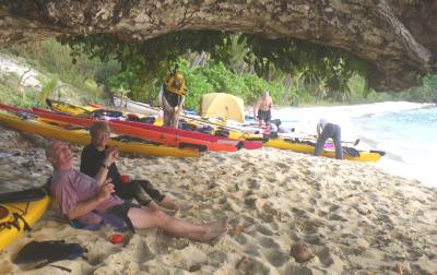
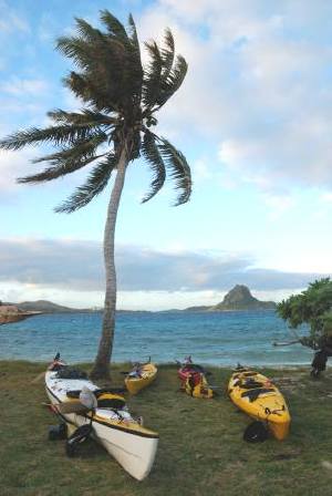
We again awoke to beautiful sunny weather on day three. After a hearty breakfast of bacon, eggs, flat bread and green tea we packed up the site, loaded the boats and headed for Prideaux Haven, a distance of 10 kilometres. There were over 20 boats anchored in Prideaux Haven so we decided to venture onto Melanie and Laura’s Coves, another 7 kilometres, to see if we could locate a nice pristine campsite. Melanie Cove was awash with massive oysters the size of your hand and when the meat was taken out of the shell one had a palm full of delicious oyster meat. Tarquin and David were not real keen on the oysters and had to ‘drag’ KB away after he just could not stop eating them. The campsite at Melanie Cove was too rocky and subject to tidal flooding so we ventured to Laura’s Cove. We located a very nice campsite at Laura’s Cove, complete with a drop-pit toilet, freshwater stream and a great picnic table and seats – heaven at last!

Tarquin and David decided to hike over very hilly terrain from Laura’s Cove to Melanie Cove, a distance of about 12 kilometres while KB stayed in the camp and enjoyed the solitude, fruitless fishing attempts and entertained a few Canadians with his stories! Late in the afternoon we enjoyed a brisk swim in the sea  jumping from high rocks and entertaining the local boaties – yes, it was very cold water but certainly well worthwhile.

Tonight was a full moon and at about 0400 a pack of wolves moved very close to our camp and started a cacophonic chorus that chilled us to the bone. I heard Tarquin whisper to David – ‘are you awake’ with an instantaneous response of ‘nuh’! We had our bear spray which apparently works on wolves and cougars so we decided to stay in the tent and hope that they would retreat. No sleep for the rest of the night and when we removed ourselves from our sleeping bags we found wolf droppings 10 metres from the tent – Shit O’Reilly!!!

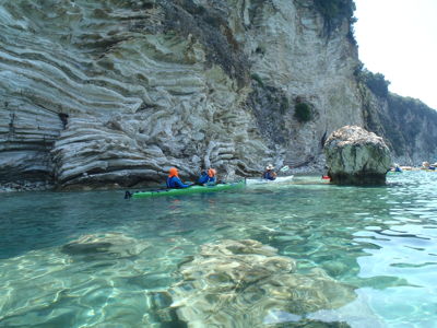
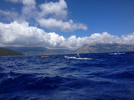
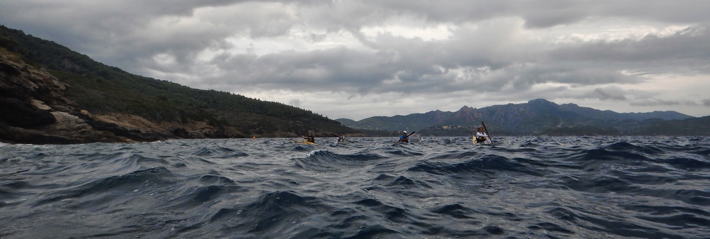
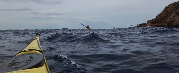
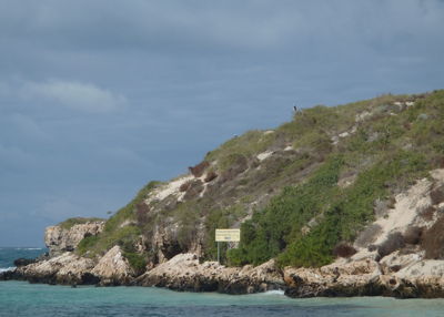
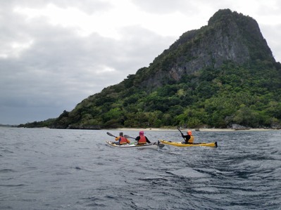
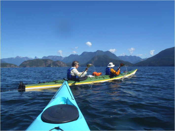
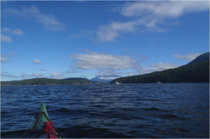
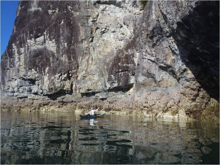
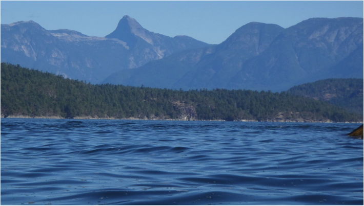
Day four was another perfect day in paradise! We decided to paddle from Laura’s Cove across the Homfray Channel to Roscoe Bay Marine Park located in a cove on West Redondo Island, a distance of around 14 kilometres. The seas were very calm and we could see awe-inspiring snow capped mountains in the distance. As we left Laura’s Cove we paddled next to a massive rock face that rose vertically out of the sea to a great height – we felt very small when parked up against this in our small kayaks.

We entered very sheltered waters with the depth only about one metre at the entrance to the cove and witnessed a boatie hit the bottom at speed and do severe damage to his propellers. We paddled a further one kilometre to the end of the cove and located a premier campsite on high flat ground with a view back towards Melville Island.

Lugging the boats up to the high ground was a bit of a chore but we had learned that the tides were very high and sometimes unpredictable. Directly behind our campsite was a walk trail to Black Lake – a freshwater lake that provided us with another perfect location for a swim and to enjoy the sun while lying on the rocks. As we arrived at this campsite early we prepared a gourmet Mediterranean lunch with olives, the last of our cheese, tomatoes, crackers, GF flat bread and nuts washed down with copious quantities of green tea.

This campsite was so pristine and comfortable that we decided to call a rest day and spend day five at the lake swimming and relaxing.

Laura's Cove
Tarquin in front of massive rock rising directly out of the sea out from Laura’s Cove

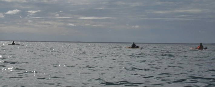
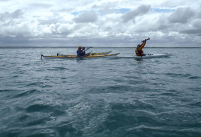
After a very invigorating rest day at Roscoe Bay we rose early on day six for the paddle to Portage Cove and then to our final overnight camp located at Galahad Point in the beautiful Theodosia Inlet, a distance of 22 kilometres if we were able to utilise the Portage Cove crossing, or 31 kilometres if we were unable or not permitted to use the crossing. The paddle across Homfray Inlet was breathtaking with magnificent mountain views, playing seals and frolicking dolphins following our every move. We heard Orca’s ‘blowing’ but could not get within a suitable distance for photographs.

When we arrived at Portage Cove our hearts began to flutter and we all hoped and prayed that the owners of the land would not be on site as they were known not to appreciate paddlers crossing their land and we had heard rumours that they would set their dogs onto any trespassers! Following a discussion Tarquin and David decided to send KB up to the house while they waited in the boats at a safe distance. KB gingerly stepped ashore and headed for the house – absolute elation followed when it was obvious that no one was ‘in-residence’. The owners were not there and so we were able to carry the double and the single and all our gear over a grassed 300 metre hillock to the other side of the cove and the start of Lancelot Inlet! We were so delighted that no one was home we decided to have a gentleman’s picnic lunch under the over laden apple trees and assorted fresh bear droppings from their previous evenings feast.

We set off in the kayaks to Theodosia Inlet and then spotted our campsite at Galahad Point. The tides were supposed to peak in the next hour so we decided to set up the camp, the tent and a cooking fire on what we thought was high ground and well above high tide! To our horror the tide kept coming in and eventually we moved the tent up to higher ground as the ‘hiss’ of the fire being put out by the rising water was heard! We then moved the fire up onto a very small camp site and re-packed all the bags ready for a quick departure in the kayaks and a night paddle back to Okeover Inlet. Luckily for us the tide started to recede just on dark and we were able to stay our last night on what was now an ‘island’ in the middle of the inlet. It was an exciting time deciphering the tides and bought home the fact that you cannot totally rely on tide charts that are not precisely ‘local’.

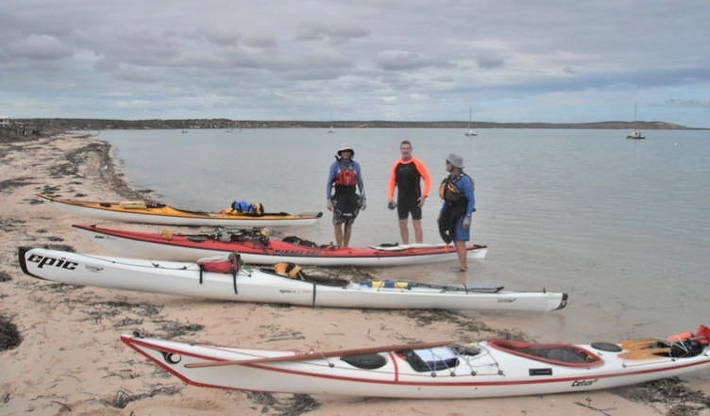
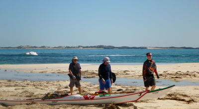
Day seven dawned with yet another magnificent sunny day with virtually no wind and no tide movement. Today we would paddle through Lancelot Inlet and then into Okeover Inlet, past Hillington Point and Coode Peninsula – a distance of 16 kilometres. At the end of Coode Peninsula we turned North around Boundary Rock and raced the final 500 metres to our launching point and kayak hire shop.

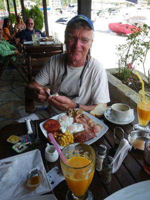
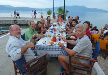
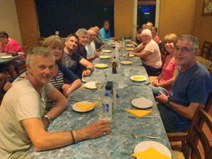
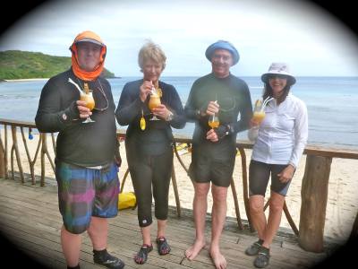
The next two hours were spent unpacking the kayaks, cleaning the kayaks and driving the short distance to the ‘Laughing Oyster Resort and Restaurant’ where we had booked sensational accommodation and enjoyed one of the best seafood meals we had enjoyed in any part of the world washed down with excellent Canadian wines!

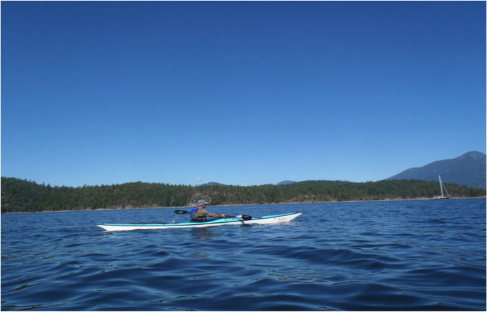
Over the seven days we had paddled approximately 100 kilometres of absolute pristine waters, viewed wildlife and above all, developed camaraderie and friendship that would last a lifetime!

David
David stretching out in the single kayak
Point Peak
View towards destination with Point Peak in background
Papanicolis Cave on Meganisi - Photo by Pavlos Georgilas

Ionian Odyssey Greece 12-20 June, 2014

By Sue Harrington and Pel Turner

Judy, Barb Manson, Jo Foley, Wolfgang Wetzig, Pel Turner, Russ Hobbs and Sue Harrington from SKCWA were joined by Jo’s friend, Nicki Thomas. Anastasia, John and Glen from Newcastle, NSW made up the group, along with Pavlos and Yvonne as trip leaders.President Judy Blight’s descriptions and photos of her kayaking trips in Greece have captured our imaginations over the years, so we jumped on her suggestion of a group trip. Arrangements were soon made with Yvonne and Pavlos at Sea Kayaking Kefalonia, with whom she had enjoyed wonderful trips twice before. We signed up for the nine-day Ionian Odyssey trip, starting at Kefalonia and paddling between various islands in the Ionian Island chain in the western part of Greece. It was to be a cushy trip, staying in nice accommodation with breakfasts and dinners in village tavernas and picnic lunches on the beaches.


The whole crew – Photo Russ Hobbs

After having travelled from Athens or other European adventures, we all arrived at our comfortable apartments in Vlachata, Kefalonia, the base for Sea Kayaking Kefalonia. On a hot afternoon we gathered to introduce ourselves over the first of many cold beers, received a trip briefing from Pavlos, met the other staff and the family dog, Goofy, chose kayaks and gear. Pavlos had tried his hand at woodworking and made two Greenland paddles for our use (though Wolfgang recommended some fine tuning) and a large outdoor table for meetings. Feeling the heat after standing around in the sun, we headed off for another beer and the first of our convivial dinners.

Our excess belongings stored, we were picked up the next morning for the drive to Fiskardo on the northern tip of Kefalonia. On the way we passed pens of Sea Bass and Sea Perch and evidence of the 1953 earthquake, which destroyed many villages, now re-built. Interestingly, the buildings in the Ionian Islands tend to have cream walls and brown terracotta roof tiles, more like Croatian architecture than the typical blue and white of the Aegean islands.

[

First paddle day. Having arrived at the pretty village of Fiskardo we had a short (5nm) introductory paddle to the south, circling a limestone island rookery of yellow-legged gulls and having the first of our healthy and delicious beach picnic lunches. Of course there was some pleasant snorkelling and kayak rolling in the crystal clear water before we headed back to Fiskardo. We noticed this day and throughout the trip that the incredibly clear, blue-green waters supported little marine life, perhaps because of over-fishing. Our Newcastle companions taped large inflatable Tele -Tubbies to their kayaks as mascots that, not surprisingly, got some looks from the locals. The mascots didn’t last the distance though as they couldn’t cope with the wind.


Jo Foley rolling in the crystal clear water – Photo by Pavlos Georgilas
Teletubby mascot – Photo by Pavlos Georgilas


Barb Manson at the entrance to the first of many caves visited – Photo by Judy Blight

The evening activities became a welcome pattern. We would settle into comfortable apartments with water views or nice gardens, rinse out paddling clothes, shower – Greek bathrooms often don’t have shower screens or curtains so water goes everywhere – have a short break and then head out with the group for beers, dinner and lots of chatter at a taverna. Sue and Russ added to the cacophony with their coughing, due to a lurgy they had all trip!

Fiskardo to Sivota.

After a leisurely and decadent cooked breakfast we checked out the ruins on the point – a Venetian lighthouse and 6th century Benedict ruins – and then loaded our kayaks, gear and ourselves onto a ferry going north to Vasiliki on Lefkada Island. After finding the usual access to the water was blocked by a construction site we had to carry our gear and boats to a rocky bay. Here we launched for a calm and pretty 9nm paddle eastwards to the village of Sivota, set in a long narrow harbour full of tourist yachts. Today we surprised Wolfgang by singing happy birthday at lunchtime on a beautiful little beach while he was surrounded by beach babes! Then there was a cake and candles at dinner. Tonight started a regular pattern where Yvonne would save our fish scraps and feed them to needy cat families of which there was always an abundance!

End of the day at Spartakhori – Photo Russ Hobbs


Wolfgang’s birthday – Photo by Pel Turner

Sivota to Spartakhori.

Heading down to the glistening harbour from our apartments we passed by the village church and the music of Sunday hymns and on to yet another lazy and delicious breakfast. We launched watched by a family of ducks and some yachties onto shiny, calm seas and headed north-east past spectacular, banded and folded limestone cliffs. After a short crossing to Meganisi Island we paddled south past more stunning cliff-lines and into many caves. Pavlos entertained us by rolling underwater and paddling in his upturned kayak, arms and paddle above the hull, ostensibly as a method for passing beneath a low cave entrance. We ate our lunch picnic in the huge Papanicolis cave where a Greek submarine hid during WWII, emerging at night to attack German vessels.

Cliffs of Meganisi – Photo by Judy Blight

Wolfgang’s big breakfast at Sivota – Photo by Sue Harrington

In the afternoon we backtracked northwards up the western side of Meganisi Island and into the protected harbour of Spartakhori, making a total of 9nm for the day. After cold beers at a cafe on the beach, we climbed up a steep hill to our accommodation in the old village, while our gear was driven up in a classic old Datsun ute by the lady owner of the apartments. Dinner was at a nearby taverna owned by an old lady who had only recently stopped doing her usual party trick (remembered by Judy from a previous trip) where she would walk around the taverna with a large table balanced upside down on her head!

Skorpios.

Today we did a return day trip of 8nm from Spartakhori to the island of Skorpios, previously owned by Aristotle Onassis and more recently by a Russian owner. Security was high, with guards appearing from nowhere as we paddled by. After paddling around half of the island we were turned away by a security guard from a wide beach previously accessible to tourists, and paddled back to land on the only remaining, small, public beach. There we had a restful lunch, snorkelling, rolling and skills practice, with the additional feature of standup paddling, achieved more successfully by Yvonne and Pavlos than by most of us! We returned to Spartakhori for a second night in the same comfortable apartments.

Yvonne at Skorpios – Photo by Pel Turner


The only public beach on Skorpios Island – Photo Russ Hobbs

Spartakhori to Kalamos. After a breakfast of banana, beautiful Greek yoghurt and pastries we had an early start. It was lazy paddling in glassy conditions with misty views of mountains and islands as we headed east across the northern coast of Meganisi. We took our time as we moved past the creamy cliffs, attractive coastal vegetation and charming islands. The 5nm crossing to Kalamos Island was easy paddling in flat conditions.

Barb and Pel north of Meganisi – Photo by Sue Harrington

The coastline along the northern and eastern sides of Kalamos Island delighted us with caves and cliffs of limestone, sandstone and conglomerate containing shells and corals, topped with clumps of slender, green Mediterranean pine trees and high peaks rising above, with the occasional brave goat on the steep slopes. Across the strait we could see the multi-rise apartments of Mitika on the Greek mainland.


Judy, Jo and Pel off the cliffs of eastern Kalamos – Photo by Pavlos Georgilas

After a couple of swim breaks, punctuated by a new kayak game trying to shoot a flat basketball into the hatches of the boats, we paddled past some disused, picturesque flourmills into the village of Kalamos, having covered 14nm for the day. We settled into our apartments, enjoying great views over the harbour, before walking past olive groves into the village for drinks and dinner overlooking the water. Cats are everywhere in these villages and a cat fight and aerial acrobatics provided some entertainment.
Dinner at Kalamos – Photo by Pavlos Georgilas

Kalamos to Vathi. An early start again so Yvonne delivered warm cheese and spinach pastries for breakfast before we headed to the harbour. Conditions were similar to yesterday, with mist over mirror-smooth water. We crossed to Kastos Island and paddled down the protected east side with endless folded and tilted limestone cliffs, caves, small pebbly beaches and wind-bent Cypress pines. Kastos village at the southern end of the island was an opportunity for coffee and fresh orange juice before making the 5nm crossing to Atoko Island (the end of the day’s 11nm paddle).

Cats at the dinner table – Photo Sue Harrington

Launching from Kalamos – Photo by Russ Hobbs


Judy on the crest of a wave, crossing to Atoko Island – Photo by Russ Hobbs

There was some swell and wind chop initially (~8 knot wind). The group separated into several smaller groups and later Pavlos gently reprimanded us for not staying together. There was time to swim and empty the gear from boats before our water taxi arrived. Pavlos and others removed the rudders from the kayaks to prevent damage. Most of our group travelled in the first water taxi to Vathi, the capital of Ithaca. The taxi returned to bring the boats, plus Pavlos, John and Glen, to a cove on the other side of Ithaca, where they unloaded the kayaks and swam them in a short distance to shore.


Tourist boat hazard on the crossing to Atoko Island – Photo by Russ Hobbs

We settled into the wonderful Odyssey apartments, with views of the fjord-like bay and Vathi township, and did the usual clean up of our gear and ourselves. While luxuriating in the shower, Judy failed to notice that the shower curtain had blocked the drain and she flooded her and Barb’s room. Fortunately they had lots of towels! Everyone walked into the town for drinks (and to watch Australia and the Netherlands playing World Cup Soccer) and to do some tourist shopping before having yet another delicious Greek dinner.


Sue, Wolfgang and Pel enjoying the view from the apartments at Vathi – Photo by Russ Hobbs

Ithaca day. Today was a non-paddling day and the chance to see some of Ithaca Island. Breakfast on the terrace was a selection of beautiful breads, cakes and pastries made by the owner of the apartments. Then we piled into three hire cars and drove north from Vathi, past stunning coastal scenery, stopping for a tour of the 800 year old Katharon Monastery. From here we drove to the Stavros Museum where we marvelled at archaeological treasures dating back to 2,000 and 3,000BC, including items associated with Odysseus and his return to Ithaca. We continued on to the charming coastal villages of Frikes and Kioni, where we had time for lunch and shopping. Back in Vathi for dinner and an overnight thunderstorm and heavy rain.

The village of Kioni in Ithaca – Photos by Sue Harrington and Judy Blight

Vathi to Sami and Vlahata. We loaded our gear into the cars and drove to the cove where kayaks had been left. Pel, Russ and others re-assembled the rudders while we packed the boats. Heavy rain and lightning caused us to wait in the cove until the worst of the storm had passed, but then we were able to paddle south and then west around the end of Ithaca.

Waiting out the rain – Photo by Pavlos Georgilas

After a short break we crossed the 3nm strait towards Kefalonia in 15 knot winds with side-ways wind gusts and then into strong, gusty headwinds as we approached Sami, our final goal. The three other guides from Sea Kayaking Kefalonia arrived with the vehicles and we had a picnic lunch, presented Yvonne and Pavlos with Greenland paddles as thank you gifts and drove back to Vlahata. There we had a final dinner and farewells.

Final crossing back to Kefalonia – Photo by Russ Hobbs

Yvonne and Pavlos – Photo Russ Hobbs

So ended a marvellous overseas paddling holiday. We all had a fantastic time, with everything well organised, spectacular scenery, mostly excellent weather, great food and company. Thanks, Judy, for sharing your Greek paradise with the rest of us! And thank you, Yvonne and Pavlos, for your friendliness, professionalism and eye for detail; we’d highly recommend Sea Kayaking Kefalonia.

Postscript – A recent celebration of our Greek experience was a dinner held at Sue and Russ’s in late July where we dined on Greek delicacies contributed by everyone, washed down with the famed Mythos beer, and relived the fun times spent on our Ionian Odyssey.

Greek dinner in Fremantle – Photo by Sue Harrington

Marciana Marina

Elba Paddle with Sea Kayak Italy 2014

By
Alan Hale

We started 23 June 2014, at about 1330. From Marciana Marina with Gaudenzio Colltelli (Gau), Christiano from Switzerland, Teresa & Ivana from the eastern side of Italy, and Paul from Palma.

The paddle was to take seven days, (6 nights). Due to expected weather conditions we did the trip in a clockwise direction, Elba has a 147km long coastline with many small and large bays. The total area of Elba is 224 sq km and is about 80% National Parks.


My kayak fully loaded

Paul works at Palma Uni as interpreter. Before we started the paddle he told us all about his mountain climbing & cycling exploits & how he intended to circum nav (CN) UK in 2015, by kayak, (Born in Scotland). We assumed Paolo would be good @ kayaking. He pulled out of paddle at first break on the morning of second day, in what had been very soft conditions up till then. Leaving the kayak, he had been paddling for Gau to tow for the remainder of the CN. A good example of not blowing your trumpet too early. Gau spent about half hour trying to talk him into continuing, but Paul doggedly stuck to his decision to quit. I for one, secretly am very glad, with Paul, the trip could have taken weeks to complete. I tried a couple of times, during day one & on the second morning to show him a more efficient stroke, but he, apparently was more expert.


Gau towing Paolo’s boat

Gau, the owner and operator of Sea Kayak Italy, always paddles with a carbon Greenland paddle. He has the GPs manufactured by a cycle factory in Italy, to his specs, 2.4 m long. He would be as good a paddler as I have seen and a good instructor. In his younger days, Gau circumnavigated Elba in 9 hours, & paddled from Elba to Corsica in 10 hours, then returned some days later in a little over 9hrs.  He features in “This Is The Sea 5”, as the leader of a trip around the volcanic islands off Sicily, taken a few years ago.


Looking back towards Marciana Marina

All of our camps, during our CN were on remote beaches, except for the fourth night, where we were expecting rain and a friend of Gau’s has a beachside bar at a little spot called Norsi, on the south coast, so they invited us to sleep on the verandah of his bar, after closing. I chose to continue on the beach, setting my tent up there, in front of the bar, so my snoring didn’t generate too many complaints. My tent fly was a bit wet in the morning, but no probs.


Day 1 paddling

Our first day was a 5nm paddle around the Gulf of Procchio, with our camp at a remote beach, Porticciolo. Most of the beaches were volcanic/granitic soil and very polished stones. Gau had distributed 1.5 litre water bottles between us and a good share of Toscana Vino Rosso, in bottles. How would an Italian without hands or vino survive???

Between the remaining five of us two bottles per night were being emptied. 66 year old Ivana had the lion share. She was not a strong paddler but very determined. Teresa is a 55 year old and very fit. Both her and Ivana do a lot of mountain trekking. Ivana & Teresa shared a tent and were always last out of the sack each morning. We started paddling by 0800 each morning because Gau gave the two ladies a bit of ribbing about how slow they were to start. He told me that most Italians don’t get going until after 0900 & espresso.


First night camp

Day Two.  We followed the coastline northward then turned eastward toward the largest city of Portoferraio, within a bay on the north coast. This is a busy ferry terminal and the main place where most people enter & leave Isola d’Elba.


Paolo and Chris

Before getting to Portoferraio, and after about 6 or 7 nm of paddling, at quite a slow rate (waiting for expert Paolo to get some skills), Gau decided on a break at a beach, just over a hill from Portoferraio. This is where Paolo sprung his surprise. Life went on without Paolo and we paddled on, beneath one of the Napoleon homes, toward Portoferraio, stopping for lunch at another very stoney little beach outside the port area.


Teresa
Ivana, Chris and Teresa, with Mt Capanne behind
One of many caves


Following Gau through a hole in the wall

After lunch Gau did not want to risk tangling with the many fast and large ferries, entering and leaving the port so he had us paddle to a position where we had a good view in both directions of the shipping lanes. When the shipping lane was clear enough we headed toward Schiopparello, at the bottom of gulf of Portoferraio. This path was into a 10kn plus wind, a decision I found a little strange considering the skill level or paddle strength of one of the group. We did it and no bad result occurred.


Outside Portoferraio. Napoleon house up top
Paddling into campsite, night 2

That night was spent at a deep, narrow little bay called Mangani. About 17nm of paddling today. There was one yacht moored in the bay, we never saw the occupants. On the beach a German couple with their two small children, sunbaking when we arrived. They hiked up the very high, steep hill just before sunset, toward the road up the top, where their hire car was parked. Those Germans don’t mind a challenging walk, and getting their clothes off, even with small kids in tow.

Day Three. After typical Italian breaky, pani and strong black coffee, we headed north toward Capo Vita.


Beautiful cliffs behind Chris and Teresa

Chris and Gau

The run, SE down the east side had much larger swells than we had previously encountered. The other four stayed well out but I followed the coast, just avoiding the breakers, enjoying the big rebound. Practice for Albany paddles. Most of the east coast had many signs of a long past iron ore mining industry. Rusted jetties and facilities. Beautiful coastline all the same but not really touristy.


Old iron ore mine on east coast

We stopped at Rio Marina, about a third down the coast, for lunch and to replenish water and tucker supplies at a local super market.


Lunch stop and re-supply at Rio Marina

We paddled on toward our next night camp at Istia. This was our best camp with a pine forest about ten metres off the waters edge. Here I slept on pine needles instead of pebbles, good.

I go back in timeline here to mention the most challenging episode of the trip. When we got to Punta Cannelle, to commence the 2.5nm paddle across Gulf Di Portoazzurro, we grouped and recognised the point we aiming for on the opposite side of the Gulf, then started. About halfway across, black clouds appeared over the Mountains west of us and seemed to be travelling in the same direction as us. Lightning started way to our west and northwest and we could see heavy rain behind us. At this time we still had full view of Istia. The wind changed to a westerly direction and suddenly increased to 20kn plus, with heavy rain. Ivana was not able to control her boat and was being blown downwind, sideways. The visibility became 10 to 20 metres, so impossible to pick our destination, which was probably only 1.5nm ahead.

I could no longer see Gau, Christiano or Teresa who, only moments before were only 20 to 30 metres to my right rear. I could now only just see Ivana, to my left and travelling away sideways, quickly, toward the open ocean. I managed to turn toward her and over took her to stay on her left side, got Ivana to put her paddle under her foredeck safety lines and hold onto my deck lines while I continued to do lots of extended, left sweep strokes to keep us going forward instead of sideways.

Next hail stones started, small at first and getting bigger. I was wearing a thermal top and and a Reed top over it with a bucket hat so except for the biggest stones my neck was a bit exposed. Poor Ivana had a ball cap, (thin one), and only a thin short sleeved rashy, also she was on the windward side of me and was copping the worst of the hail stones. Good planning by me, eh???? I guess at that time it would not have been appropriate to make any “hale damage” jokes. Ivana was yelling and screaming each time one of the bigger hail/Hale stones hit her. The worst of the storm passed over us in less than 10 mins but during, it seemed an eternity. Within another 10 mins after the storm passed, we had blue sky and light wind from left rear.


Just before the big storm hit

The other three paddlers were about 200 m to our left rear. We headed quickly to Istia, dragged our boats ashore and headed up and over the hill to a bar for drinkies. Tents could be taken care of later. Then came the stories, some bigger than Ben Hur. Teresa had large bruises on her right shoulder and upper arm, Gau, who was also only wearing a light, short sleeve rashy and no hat. He had bruises on his melon.

I WONT LET THE  “FACTS GET IN THE WAY OF A GOOD STORY” .
Gau told us later that he saw Hail Stones, some as large as golf balls on his spray deck. Believe it not?????
I never thought of pulling my camera out during the storm, I wish I had.

Day Four. Istia to Norsi. Lunch at Morcone. About 10nm of paddling in nice conditions. Once we got to the area of Cape Calvo we again started to see more evidence of the former iron ore mining. It looks pretty small scale compared to the Pilbara.


Christiano doing yoga at sunrise

Morning after the big storm
Going down the SE coast

Old stone and concrete structures, rusting steel work, all part of the mines were very prominent. At one place I could see something moving on one of the structures, when I moved closer, it was dozens of goats.


Heading for Morcone

Ivana and Gau with old iron ore infrastructure behind
Lunch at Morcone Beach

When we eventually arrived at Norsi, Gau was told by his bar owner mate that more bad weather was expected on the coming Sunday, our last day of paddling. Gau checked all this on his phone and made a decision that we compress three days paddling into two, finishing on Saturday.


Bar owner and our crew at Norsi

Day Five. Friday. Norsi to Giardino with lunch at Marina di Campo, MdC.

I told Rose by txt on Thursday night that we would arrive at MdC about 1100. Rose had been using the public transport system to see most of the island from the landside. We met for lunch at one of the many seafood restaurants on the MdC sea front. Germans everywhere here, all of restaurant menus are in Italian & German.


Passing Capo Stella on the south coast

This day’s paddle was a display of large colourful geological structures, lots of caves, with nice weather and water.


Another cavo – lucky we don’t get bored

Teresa and Rosemary at Marina di Campo, for lunch
Three resting in Cavo

Our night camp was on the SW coast, straight below the very scenic road that hugs the cliff tops for 10 or 11nm from La Conca to Colle Palombaia. EAT YOUR HEART OUT GREAT OCEAN ROAD.


Ladies about to get roll practice with Gau at Giardino camp

Two of Gau’s lady friends parked at top section of road closest to Giardino that evening, climbing down to have dinner with us during a beautiful sunset.


Last camp at Giardino

Day Six, Grande Finale. Giardino to Marciana Marina with lunch stop at beautiful little Patresi, with 1litre glasses of birra.  Still about 5nm from MM. We would have done more than that because we spent that last leg hugging every twist and turn of the spectacular coast, rock gardens and caves, swimming from our kayaks and lots of rolls. Avoiding scuba and snorklers, lots of nudes on the granite boulders. Again, more good, easy paddling conditions, caves and other geological scenery.
We finally arrived at MM around 1700.

I can highly recommend this trip as a kayak paddle. I already have it on my list of trips to do again, in a year or two.  This trip could easily be done in four days, with experienced paddlers. I saw every little nook and cranny while waiting for a couple of the other paddlers.

“Besir Bay” Pulau Gam.

Kayaking Raja Ampat (The Four Kings) – October – November 2013

By
Adrian Gawned

Raja Ampat, an archipelago of some 1500 islands, in the West Papua province of Indonesia. A marine ecology long renowned to divers the world over, but how to Kayak this area?

Research showed it could be done as Alex Vogel (WalkaboutAlex) and Halim (Deceased) of Sumatra Savages, had blogs on the internet. This led me to kayaks4conservation, a not for profit organisation, run in conjunction with Raja Ampat Research Conservation Centre (RARCC) and Conservation International.  RARCC aims to end shark finning and explosive fishing by the locals by helping them set up homestay and tourism related businesses. 8 Kaskazi sea kayaks built locally are used. http://kayak4conservation.com

Deciding to circumnavigate Pulau Gam, and arming myself with all the information about tides, currents and winds I left Perth for Jakarta on the 21 October then onto Sorong when I purchased food supplies from the 2 supermarkets. With no availability of methylated spirit or gas canisters, my tea light candle stove trialled in Albany was required for making tea & coffee. A multi fuel stove using unleaded petrol is the other option.

Oct 24 I ferried to Waisai, transferred to RARCC on Pulau Kri where I met Tertius the manager of the initiative and liaison between the park and scientists who do research in the area.  Collecting boat, equipment and necessary safety items including a spot tracker I was nearly ready to go.

After dinner with Tertius and a group of marine scientists, my first test, 2 nights in the Water Cottage (a basic hut built of pandana’s leaf and mangrove pole with no toilet facilities or fresh water) on the little island of Pulau Koh, 1.3kms away. Imagine a flat calm sea illuminated by the phosphorescence of numerous marine creatures giving the appearance it was lit by fairy lights, a taste of what was to come.


“Before Dawn” Water Cottage Pulau Koh.

Securing my kayak on the sliver of beach not covered by the tide, I slung my Hennessy Hammock, bought before I left, to ensure I was well away from scorpions, venomous spiders and adders and other nasty critters.

Lying comfortably in the diagonal, I was almost flat in my hammock; I fell asleep to the sound of the lapping water and marine life. Peace and tranquillity at last!!!! A cacophony of birds at dawn ensuring I did not miss sunrise. Paradise.

I took the time to sort what gear I needed for the 10 days (unsupported) paddling, I paddled my spare clothes and large backpack to RARCC for safekeeping and then down the coast of Kri to familiarise myself with the kayak.

The next day I crossed to Kri, collected supplied drinking water and a guide (Haja) to assist me with my journey, particularly language.

We crossed Selat Dampier and entered the maze like blue mangroves of Gam, a stretch of water consisting of inlets and channels with brilliant corals and fish life, the clarity of the water meant I could enjoy all this from the kayak. Exiting into the open sea we made our way to the first homestay at Yendebabo.


“Yendebabo” Homestay Pulau Gam

The homestays are very basic. They supply a mattress, pillow and mosquito net,  a bucket bath and squat toilet, some have 12 volt solar systems, others generators for a few hours in the evening, a thermos of boiling water is provided with tea or coffee.

The following day we headed to the islands of Friwinbonda and Friwin, the crystal clear waters providing great viewing of the corals and aquatic life under the kayak.  We pulled up onto a beach at Friwin, where Haja disappeared returning a short time later with 10 lengths of thin bamboo, which he stripped of foliage, soaked in the sea then tied them to the deck of his kayak.

A group of inquisitive children came by in a traditional dugout, one paddling, the rest bailing. My kayak was more watertight than their dugout.

We pushed on to “Five Rocks” where there is a small concrete plinth and plaque honouring the Japanese from the 2nd world war; paddling with a pod of dolphin until lunch, which was eaten on a beach on the island of Ura before heading to the homestay ‘Yenbesir Paradise’ hidden between numerous limestone karst islets.


“Fishing Village” Pulau Gam

The homestays on the East and north coasts are pole houses built over the water, backed by jungle or mangroves and to my surprise ‘Yenbesir’ provided a crisp white sheet, pillowcase and a towel that smelt “lemon fresh” straight from the laundry.

Watching my hosts’ children fishing and Haja build a bow and arrows from his collected bamboo filled in the afternoon. The bow and arrow were for hunting wild pig on his home island of Mansoear.

Dinner was freshly caught snapper, with rice and noodles. For dessert a packet of coffee crème biscuits with the thermos of boiling water. It was off to bed to the sound of fish jumping, birds, night insects and the call of a buffalo in the jungle.

Monday the 27th of October, the sun lit up this magnificent bay, the birds were active particularly the local butcher birds that called constantly as did a resident heron.

Breakfast and then onto Teluk Kaboi near the “Passage” the narrow channel between the islands of Gam and Waigeo, renowned for its drift diving, on the surface depending upon the tides it can be a millpond or a white-water course.

After repairing a broken rudder cable we continued across Kaboi Bay to our destination, the water changing from brilliant turquoise and blue to dark green.  Approaching the “Passage” and Teluk Kaboi we paddled amongst the islets to the homestay at Teluk Kaboi.  The potential for this homestay is amazing with it being tucked into the side of a cliff, built over water with a permanent water supply from a cave above.  Unfortunately it was also the most basic and not for the faint hearted. A Pinisi live-aboard Dive boat was anchored in the bay.


“Pinisi” The Passage.

Tuesday we headed for the entrance to ‘The Passage’, it was almost slack tide and as it was a neap cycle the currents were not as strong.  Rounding the point we drifted into ‘The Passage’, less than 20 metres at its narrowest.

Negotiating several narrow turns we broke out into the wider channel where the current was non-existent.  We set to crossing Warparim Bay for the “Hidden Bays of Pef”.  Midway the rain started, the wind picked up creating a wind wave, we pressed on. The first clap of thunder was far off, there was no lightning, within minutes the storm was overhead, thunder crashed and the first of many lightning bolts hit the water, we needed to get off the water, our options were limited. Run for the mangroves 3.5 km away or to a permanently moored fishing vessel about 2km distant.  We chose the fishing boat.

We clambered up the sides of the outriggers and negotiated planks and stays to reach the main hull, where we were offered food and tea by the crew. A local in an outboard powered outrigger canoe arrived seeking sanctuary.


“Tropical Rain” The Passage.

The storm passed, we paddled on to the hidden bays, a myriad of inlets, fingers and channels, where we passed a group of divers and a partially completed homestay, my guide would not venture at all into the bays to our left stating there were crocodiles; we drifted on the currents taking in our surroundings.

From the hidden bays we continued toward the island of Pef, where we planned to camp. Reporting to the Police at the Indo Pearls pearl farm (an Australian venture staffed by Japanese) and registering the duration of our stay in the area as required.


“Sunset” Pulau Gam.

We continued to Pef where Haja advised a ‘saltie’ had been seen in the area we would camp, instead we would camp at the rear of the Raja for Divers resort. Paddling into the black water lagoon at the rear of the resort surrounded by mangroves, it looked a perfect habitat for crocs. I discovered people dived here to see pygmy sea dragon and nudibranch.

Discovering Haja had friends working at the resort, I wondered if the croc story was true!

Wednesday the 29th I was awoken with roosters crowing and the generator at 0500hrs. We paddled to Airborek arriving around lunchtime, washed away the salt, clothing was hung out to dry and boats opened up to let air and sun into them to dry them out,  they had taken water the previous day.

The afternoon was spent snorkelling on the nearby reef with barracuda, black tip shark, turtles, rays and numerous other species.   A walk around this little islet took about 30 minutes.  As the sun set it was a good opportunity for photographs. The staple diet of the islands, rice and fish, for dinner.


“Mushroom Coral”  Pulau Airboraik.

Pulau Airborek, like many small islands in the Pacific is barely a metre above sea level and there is evidence of increased erosion, with global warming rising sea levels will see it inundated in the future, houses are already built on stumps about a metre high for the not too infrequent high tides that occur and flood the immediate coastal area.

Thursday began with the birds and barking dogs, a late start was planned to avoid the outgoing tide, with a short paddle to the homestay near Sawingrai village on Gam. A broken rudder cable along the way made the paddle that much harder.

My cottage was a few feet from the water’s edge and provided great views of the sunset.  It was one of the few facilities with a tiled floor, but the generator in the toilet was somewhat off-putting. The bucket bath was always a welcome event at the end of the day; however water conservation was an issue as the women had to obtain water from a well some distance away.

After another magnificent sunset I went to bed to the sound of the generator, coconuts falling from the trees and other unidentified night sounds.

Up at first light I watched as the open wood fire was lit in the lean-to kitchen.  Breakfast a plate of hot fish cutlets cooked in a chilli sauce and 6 small bright green pancakes filled with fresh coconut and sugar started the day.

A short 3 – 4 hour paddle to Besir Bay, the rumour of a ‘saltie’ near the mouth meant we scanned the shoreline and our surroundings closely, every piece of timber on the surface given added attention.


“Besir Bay” Pulau Gam.

We headed for a limestone tunnel that at low tide allowed you to enter another lagoon, and wandered among the islands and fingers, investigated a cave inhabited by fruit bats and continued to the tunnel carved through the limestone karst, with the tide out we paddled through and into the lagoon, the water however was murky and surrounded by mangroves it was not inviting.

Exiting the tunnel we continued further before a stop was made at a limestone outcrop in the middle of the bay, where we climbed a rustic wooden ladder up the side of the formation to higher ground to get a magnificent view of the bay and its islets.

Back onshore it was time for lunch, we then walked to Sawingrai village to find a guide to take us into the mountains in search of Wallace’s Red Bird of Paradise (named after the naturalist Alfred Russel Wallace). We entered the jungle and then waited, the guide pointed into the tree canopy above, there were about four of these magnificent birds.  We sat and watched as they preened, sang and flew through the canopy. A photo cannot do them justice.


“Besir Bay” Pulau Gam.

Saturday 1st November the day started at sunrise, up and about and packed in preparation for the last leg to Pulau Kri.  Having had a breakfast of cassava chips dipped in batter then deep fried with a cup of sweet black tea, we headed up the coast of Gam toward Kormansiwin village, the tide was still running out rapidly, my guide suggested crossing the Dampier Strait immediately but I chose to paddle along the coast instead until the tide was spent, then cross.

We stopped on a beach for a brief stretch and drink then resumed our paddle up the coast until the current had eased then turned east to make the crossing to Pulau Mansoear and the village of Yenbuba 7kms distant.

Arriving at Yenbuba we pulled up on the beach, got out the lunchboxes as the rain and thunder started yet again, we ate in silence watching the rainstorms roll up the Dampier Strait over Pulau Mansoear and continue to Gam and Waigeo in the distance.


“Rainstorm” Pulau Mansoear.

Lunch over we crossed the channel between Mansoear and Kri, and then followed the shoreline of Kri to Sorido Bay Resort and RARCC where the paddle would end.

Accommodation for the last night was luxurious, an air-conditioned room, with a hot shower, a real toilet and a comfortable bed.  Lunch at Sorido Bay comprised a huge variety of dishes, salads, eggs and chicken the first I had seen in over 10 days and was taken with divers from all around the globe enjoying the underwater delights of the area. I was known as Kayakman and introduced as such.

After lunch I packed gear and then sat in the waterside gazebo watching a school of black-tip reef sharks patrolling along the beach.  I dined with the other guests and had just a single celebratory Bintang beer which was enough to send me off to bed.

My final day in the “Four Kings” I opted for the late transfer to get a last snorkel on the house reef, it was memorable, brilliant red starfish, angel fish, clown fish, huge bump-head parrot fish, black-tip reef sharks and turtle the list went on. It was a fitting end to what had been a magnificent 10 days around Pulau Gam.


“Red Starfish”  Sorido House Reef.

The boat to Sorong arrived at midday and I headed off on the homeward leg of my adventure vowing to return to see and do more of the area before it is destroyed by mass tourism and consumerism. (Haja my guide spent the days collecting floating debris in an effort to preserve the environment).

Thanks go to Halim (aka Georg Jackstadt) from Sumatra Savages for setting me on this path, sadly I couldn’t tell him I did it, he passed away from Black fever* in March. Alexander Vogel (Walkabout Alex) who has done the area twice by kayak and intends to go back, his knowledge and advice was invaluable and lastly Tertius Kammeyer for all his help and assistance. Planning for stage two has already begun.

Anyone who considers travel to this area without the necessary prophylaxis for Malaria and injections for Japanese Encephalitis, Typhoid and Hepatitis A should reconsider their plans, expensive as they are, it is worth remembering these diseases can kill or maim you.

Distance: 180kms
Kayak hire USD $520.00 for 10 days.
Boat Transfers USD $185.00.
Sorido Bay Accommodation USD $180.00.
Guide USD $240.00 for 8 days.
Homestays USD $280.00 (7 nights) inclusive of 3 meals per day.
Airfares, Accommodation and Sundries. USD $1800.

*Black Fever (Visceral leishmaniasis) is a disease borne by the female sand-fly and the second-largest parasitic killer in the world (after malaria), responsible for an estimated 500,000 infections each year worldwide. The parasite migrates to the internal organs such as liver, spleen, and bone marrow if left untreated it will almost always result in the death of the host.

About the author:

Adrian lives in Albany where he runs his own business, he has been paddling on and off over the years and joined the Sea Kayak Club in 2011. Previous expeditions have included the Gulf of Thailand and Koh Chang Islands Group. He prefers to paddle solo for the solitude or with 2 to 3 other paddlers.

© Adrian Gawned 2013

Ningaloo Reef 26 July – 4 August 2013

Ningaloo Reef 26 July – 4 August 2013

By
Jacki Hollick

For those of you who have already experienced the wonders of Ningaloo Reef, I apologise for the extensive use of superlative adjectives in this report as you already know how wonderful it is. For those who have not, Ningaloo Reef is ABSOLUTELY AMAZING.
The trip involved a pod of 8 paddlers staying at Yardie Creek Homestead caravan park in two cabins as a base with various day trips along the Ningaloo Reef from Yardie Creek up to Mangrove Bay.

The weather was glorious with blue skies, average top temperatures of 26-28 degrees and strong easterlies in the morning and previous night, dropping down to a gentler wind in the afternoons. For a couple of days, a south westerly came in but only for about a couple of hours or so.

The paddlers were Paul Cooper, Wolfgang Wetzig, Barry and Chris Roberts, Margaret Banks, Jo Foley and Ian and Jacki Hollick.


Outside cabin – Barry, Chris, Paul, Wolfgang, Jo, Ian, Jacki, Margaret. Photo by Ian Hollick.

When asked what the highlights of the trip were, these paddlers replied:

“The third day was the best. It was the perfect day with gentle breeze, cloudless sky and fantastic surfing. I’ve never experienced a more balanced paddling day.”

“The wildlife – Emus, Roos, Wallabies, birds, echidnas, Dugong, turtles, Rays, Tuna. The variety of things to do. The company. The sunset.”

“The third day. The look on Wolfie’s face when he caught that wave surfing. The paddle from Sandy Bay to Turquoise Bay when the wind picked up to 20 knots, top travelling speed of 13.2 kms per hour. Seeing that Tuna and the sunset.”

“The company. The turtle that popped up so close to the boat. The surfing. Sandy Bay was the best. Watching the whale breaching at the Exmouth Marina.”

“The camaraderie and great friends. The colours were amazing. The blue of the sky, the tropical blue sea, the springtime greens and the yellow and purple of the wildflowers. The iron reds and greys of the gorge at Yardie Creek and the amazing sunset at the Lighthouse.”

“The snorkelling and the fish. The surfing.”

“The clear sea and so many fish. The different colours.”

“The surfing and different paddling days. It was such a relaxed time with plenty of excitement on top”.

So, what happened? Well……

Friday and Saturday were spent driving up with stop overs at either Billabong Road House or Carnarvon. A storm had come in on Thursday and through into Friday, so the beginning of the journey was difficult with gale force winds and heavy rain. However, past Geraldton was different with blue skies and no rain.

On Sunday, we started the paddling with a short drive to Lakeside, where the reef is close to the beach and we got our first view of the beautiful turquoise clear water and the sound of the waves breaking out at the edge of the reef (continuously along the coastline).


Leaving Lakeside. Photo by Ian Hollick.

We set off south and it wasn’t long before turtles were popping up out of the water to have a look at these strange vessels or were swimming under the boats at great speed. We didn’t see another boat inside of the reef!

We landed at Turquoise Bay, which is renowned for its snorkelling which I’ll talk about later. And, yes, the water is bright turquoise.
After a short break, Jo and Paul ventured onto Oysters Stack when they were lucky enough to see a tuna fly out of the water alongside them.

After the longest paddle of the trip, we returned to the cabins and either cooked or joined the Christmas in July evening meal at the caravan park ‘restaurant’. Barry, Chris, Ian and Jacki enjoyed turkey and all the trimmings for dinner which was quite quirky in the middle of nowhere!

Monday proved to give us an even better paddling experience. We set off from Sandy Bay which is ‘picture perfect’ with white sand and clear water, and nobody else around!


Sandy Bay. Photo by Ian Hollick.

Kayaks lined up on Sandy Beach. Photo by Ian Hollick.

We paddled south for a while when we had a wonderful aerobatic display from a couple of sea eagles soaring directly above us.

After lunch, 6 of us paddled out to a special kayak mooring that Jo knew about at the edge of the reef. We rafted up 4 boats to the mooring and Wolfgang, Margaret, Jacki and Jo spent half an hour snorkelling in the deeper water while Ian and Paul went out further to check out the surfing for future reference.

When we got back to Sandy Bay, we enjoyed some rolling and bracing practice in warmer waters than we have been used to recently in Perth.

As with all evenings, we spent the end of the day discussing our experiences of the day over dinner and a glass of wine.

So, surely the next day, Tuesday, couldn’t top the two previous days of paddling. Wrong. The third paddling day was the best.

We started at Ned’s Camp and paddled up to Mangrove Bay where the coral reef was only about a metre below us. Again, we saw loads of turtles, sting rays, sea slugs (yuk!) and Jo saw a couple of small sharks in the mangroves.

Paul suggested we go out to the edge of the reef to look at some surfing. Best idea ever!

On the way out, we saw the tail fin of a fish thrashing around seeming to be trying to catch something off the reef. On closer inspection, we believe it was a 2 metre Tawny Nurse shark. As soon as it saw us, it took off but Ian put his camera under the water and managed to get a half decent shot of it.


Tawny Nurse Shark. Photo by Ian Hollick.

The surfing at the edge of the reef proved to be exciting for all. You could catch a set of waves and surf three times over!

We landed back at Ned’s camp for a late lunch and everyone went back to the cabins apart from Paul, Jo, Ian and Jacki who went to the observation hide to view the birds in the mangrove lagoon (so different to the ocean just next door).

Later on, Paul, Jo and Margaret went up to the Lighthouse to see a spectacular sunset over the water.

What a special day.


Sunset from the Lighthouse. Photo by Jo Foley.

Tuesday was going to be hard to beat, so we tried something totally different on Wednesday and drove down to the Yardie Creek itself, a water gorge, apparently about 14 kms long but much shorter for paddling access.


Paddling up Yardie Creek. Photo by Ian Hollick.

We paddled up as far as we could go checking out the rock wallabies emerging from caves above us. The contrast in colours was amazing with the blue water and sky, bright red rock soaring up and green bushes.


Rock Wallabies emerging in the morning sun. Photo by Ian Hollick.

We ventured back to Sandy Bay either by boat or car and then drove on to Turquoise Bay for some snorkelling. Turquoise Bay has a strange phenomenon of a ‘drift’ which sends the snorkeler along the beach without any effort of swimming. This means you can just watch the fish as you go by. And there were plenty of fish of different colours, blue, green, yellow and even pink.

Margaret demonstrated her snorkelling skills, frequently diving down to get a closer look at the fish that we pointed out to her!

Paul continued by boat from Sandy Bay back to Turquoise Bay rather than driving and had an exhilarating paddle.

Thursday was our ‘dry’ day which we spent in search of the tourist sites. We drove up Charles Knife Gorge with amazing views across the ocean.


Paul at Charles Knife Gorge. Photo by Jo Foley.
Charles Knife Gorge. Photo by Ian Hollick.

Jacki and Ian were privileged with the sight of a whale breaching over and over outside the Exmouth Marina. A local said it was the first whale he’d seen this season. What a treat!

A few of us checked out the SS ‘Mildura’ wreck, a 1907 cattle ship wreck visible from the shore and the renowned Surfers Beach.


SS ‘Mildura wreck. Photo by Ian Hollick.

Thursday night was our last night together as Jacki and Ian left a day early to return home via Carnarvon.

So, Friday’s report comes from Jo.

We woke up to another day in paradise. With Jacki and Ian’s departure yesterday there were now 6 of us. Over breakfast we discussed our options for our last day’s paddle. Wolfgang and Paul were keen to do some rolling practice before getting back to chilly Perth and the rest of us were keen to do one last paddle. In the end we decided to paddle north from Lakeside to Ned’s Camp and return, as we had not paddled that section. The plan was to then do some snorkelling at Lakeside and rolling.

When we got to Lakeside it was super windy – about 20 knots ESE so we hugged the coast as much as possible which was at times difficult due to it being low tide. When we got to the bay that held Ned’s Camp the wind was howling and seemed to be more north easterly and the water very shallow so we decided to head back with the wind at our backs to a lovely bay which was sheltered by a glistening white sand dune. We had an early lunch break which included a little sand in our food (crunch, crunch). We had an amazing view of many shades of blue ocean against a marvellous blue sky. Paul and Wolfgang treated us to a rolling display. On the way back we encountered 2 dolphins –which were the first of the trip. We also had schools of trevally and gardies leaping out of the water (I wonder what was chasing them?!?!).

When we arrived back at Lakeside the wind had dropped and it was slack tide, so the perfect time to go snorkelling at a brilliant spot 500m south of the carpark called lakeside bombies. We got our gear and paddled down. The snorkel was like swimming in an aquarium. With numerous bombies of massive coral we encountered many colourful and beautifully patterned fish of all sizes from tiny blue to damselfish to a huge groper hiding in a hole in the rocks. Margaret and I snorkelled further out and came across 2 massive rays that seemed to be about 3metres in length lying on the sandy bottom. One of them, you could only see its outline as it was covered in sand. The other was eyeballing us and we snorkelled above.  Paul and Wolfgang opted to do some more rolling practice.
It was another balmy evening and we enjoyed a last night similar to most of the others, with a bbq out on the verandah and a few wines with great friends.

The next day we set off for our 2 day journey back to Perth – Barry and Chris stopping at Carnarvon for the night and the rest of us stopped at the Old Northampton Convent for a cheap night’s rest ($20 each).

And so we come to the end of this trip report.

Thank you so much to Paul and Jo for organising such a fantastic experience to be remembered.

Also, thank you for all the photos, in particular to Ian for so many of them, and a big thank you to the whole group, you guys, for good company in the presence of great friends. We had so much fun in a spectacular and memorable place.

It was truly special.

Dirk Hartog Expedition May 2013

Dirk Hartog Expedition May 2013

By
Antony Mee

Since undertaking a solo two day paddle from Denham around Cape Peron to Monkey Mia last year I was eager to visit Dirk Hartog Island (DHI) on my next trip to the Shark Bay World Heritage area so I asked a paddling friend of mine, Lance Connop, whether he would be interested in joining me for a discovery paddle of the eastern side of the island. We invited two other experienced sea-kayakers in Paul Cooper and Graham Place to join us, set the dates and booked accommodation in Denham.

Lance called around at 0430 hrs on Tuesday morning the 14th May in his ‘Landy’, as he calls his Land Rover, and we loaded up my gear. I weighed my gear before we left and it came to 85 kg. Most of the weight comprising water for the six (6) day expedition allowed consumption of four litres per day totalling 24 litres. The other guys were carrying similar amounts. Water is the single heaviest item to carry as it weighs 1 kg per litre, therefore weighing in at 24 kg – 3 kg more than the weight of my sea kayak. The sea kayak that I use is the same one that Freya Hoffmeister paddled around Australia during her ‘epic’ adventure in 2009 – an Epic 18x Sport, except mine is slightly lighter than her Expedition lay-up. I had only used it previously for an overnight paddle from Mindarie to Lancelin so I was eager to see how she went loaded up to the maximum storage capacity of 173 kg.

After a long road trip we arrived in Denham ten hours later and caught up with Paul and Graham who had left Perth the previous day for a more leisurely trip to Denham. We booked into our accommodation at the Denham Backpackers, which is just across the road from our launch site. After a hearty meal at the local resort we retired early for the big first day paddle of 37 km across Heirisson and Bellefin Prongs to our first campsite just south of Tumbledown Point.

It took us about 90 minutes in the morning to pack and I was the last to launch after notifying Australian Coast Radio Monitors WA INC. (ACRM) in Denham of our planned route and ETA for arrival at each prong and also at DHI. The first paddle to Heirisson Prong equates to approximately 20 km (a similar distance to Rottnest Island from Cottesloe). I was a little anxious as the whole area is teaming with everything that can bite and/or cause you harm – most notably the large Tiger Sharks that frequent these waters.

We made it to the first prong in little over three hours and had a short leg stretch before moving on to the next prong. We stopped there for some lunch and then headed over to DHI. I didn’t have a waypoint in my GPS for the first campsite so we basically guessed where it might be located. When we arrived at the island we discovered a lovely bay with good sand to land on and plenty of space to set up our tents.


Tip of Bellefin Prong

Lance is an eager fisherman and before any of us had unpacked our kayaks and set up our tents he was off to the nearest point to throw a line in and try his luck. Needless to say it was fish for dinner. We all slept well that night, and successive ones, retiring at 1900 hrs and rising at dawn each day.


Campsite near Tumbledown Point

Paul and Graham wanted to spend two nights at that spot so we agreed and did a day paddle to Notch Point and Tetrodon Loop the next day. On the way north I came across a beached dugong and pulled up on the sand to investigate. The poor dugong may have been hit by a boat and some sharks have then moved in on the weakened mammal. We pushed it into the shallows and off it swam with what appeared to only be a ‘flesh wound’. This was a relatively easy 24 km paddle to the point for lunch and return. Paul and I split up from Lance and Graham for the return paddle and when we arrived back at camp they were nowhere to be seen. Ninety minutes passed before they appeared back at the campsite much to our relief. With an empty boat that day I was averaging 10 km/hr.


Injured dugong near Meade Island

On Friday 17th May we broke camp and set off southwards for Cape Ransonnet. This was an easy 16 km paddle to the next campsite which comprised a much smaller landing beach and far less clear space for setting up camp.


Campsite near Cape Ransonnet

The paddle plan was to spend two nights there, however after having climbed the nearest hill to get coverage from the Telstra Next G network and the latest weather information it was decided to drop our planned day paddle around the South Passage, out to Surf and Steep Points and make our way back to Heirisson Prong before returning to Denham. The weather forecast was not good predicting 20-30 knot southerly winds on Monday which was scheduled to be during our 20 km return paddle across from Heirisson Prong to Denham on open water. It was a shame that we had to cancel that part of the trip as the landscape and beaches forming the South Passage are stunning.


South Passage

We broke camp on Saturday 18th May and paddled in a south-westerly direction to Bellefin Prong over Shoal Flats to the head of Blind Inlet. Lance was keen to explore that area so Graham waited for him to return whilst Paul and I headed for the tip of Bellefin Prong. The paddle up the western side of the prong was more like what I was accustomed to seeing in Shark Bay sighting many sharks, sea-snakes, large fish, turtles, stingrays, etc. We waited at the tip of the prong for the others to catch up with us before departing for Heirisson Prong where we would set up our final campsite.


Approaching Heirisson Prong

We arrived late in the afternoon and found a suitable campsite. The forecast weather was closing in and during the night some light rain fell.


Campsite at the tip of Heirisson Prong

Early Sunday morning we broke camp and made the long paddle back to Denham. The wind was light and the paddle relatively easy. Lance was keen to get back and took the pace up a notch. It seemed to me that he was wanting to race. Suddenly he slowed and I wondered whether he had run out of puff or just given up trying to surpass the speed of the Epic 18x. When we got back to Denham he exclaimed that he had broken the steel cable on his Mirage 582 Tourer and lost control of his rudder. Lucky for him that it happened only a couple of kms out from Denham.


En route to Denham

After emptying our kayaks and listening to the accounts of the locals citing large tiger sharks spotted recently at the town beach we booked into our room again and went looking for some real food. After a week of canned and dehydrated offerings the food and pints at the resort were very refreshing.


Back at Denham


The paddlers – Lance, Graham, Paul and myself

Once again we all retired early and left for Perth at 0800 hrs on Monday morning. We all concurred that it was the right decision to return a day early as the wind had freshened and the weather outlook looked bleak. The return drive to Perth saw some heavy rain and wind squalls around Northampton and Geraldton.

Back in Perth, after having washed and stored all my gear, I was already thinking about my next trip to Shark Bay next May to paddle up to Cape Inscription and fix my own humble plastic camp plate to a broken paddle shaft there somewhere for the next generation to inspect and subject it to microscopic analysis just like the old Dutch pewter plate mounted there in 1616 by Dirk Hartog.

A couple of days later Lance suggested that we do a return paddle to Rotto. What, I thought, just a leisurely 40 km afternoon paddle so off we went on Thursday.


‘Forget about the sharks’! (approaching Cottesloe)

The total distance paddled at Shark Bay was 134 km.

Jurien Bay Trip 2-4 March 2013

Jurien Bay Trip 2-4 March 2013

By
Jo Foley

Feature photo – 19 Kayaks awaiting departure from Jurien Marina – Photo by Ian Hollick.

The Jurien trip this year was a little different – instead of setting up camp in a different location each day we camped at the Apex Camping group and did day paddles out to the islands and along the coast. Most people headed up on Friday and set up camp – with a few turning up on Saturday morning.

We woke up to a glorious morning on Saturday and while having breakfast watched Skydivers making the most of the still conditions. There was a great turn out on Saturday morning of 19 people so the beach at the boat harbour was a spectacular site of many different fibreglass kayaks lined up. Jacki, Ian, Barry, Chris, Dave Oakley, Rob, Neesha, Wolfgang, Steve Haddon, Lance, Antony Mee, Gordon, Graham, Margaret, Jenny, Duncan, Alan and myself were briefed by Paul before setting off into the glassy waters as the wind was only about 3 knots. Antony’s partner Bronwyn waved us off and then enjoyed her day having coffee, going for walks and watching the skydivers land on the beach. Paddling the 5km toward Boullanger Island, some of us were lucky to see dolphins and a sting ray.

Continuing on the 3km to Escape Island we were unable to find a safe landing place so backtracked to Boulanger Island for a morning tea break on a lovely white sand beach. We decided we would still continue on to Essex Rocks as planned but that it would be at least a 26km paddle as opposed to 18km that was the original plan. Duncan and Jenny being fairly new to Sea Kayaking decided to head back to Jurien at that point.  The rest of us made our way over to Essex Rocks keeping clear of the shallow reefs with large breaking waves that were between us and the island.

The Sea Lions came out in force to greet us with at least a dozen in the water and at least that number basking out on the rocks. They seemed to take a liking to Margaret who at one stage was surrounded by them. Alan gave them a fright as he rolled his kayak but they came back for more, seeming to take it as a game. With the wind having picked up a little and a following sea we scooted over to Booka Valley on the mainland, where we had a well-earned lunch break. The seabreeze had picked up more so we had a bumpy ride back to town. There were some weary souls when we finally made it the 26km back to the boat harbour.

We decided to take the night off cooking so headed to the tavern for a meal, a bevvy or 2 and a few yarns. Although it was a calm night there was wind of  another kind – who was that?!?!

Dinner the easy way – Photo by Neesha Copley.

Sunday dawned blue skies and with virtually no wind which is pretty lucky for Jurien. A few paddlers were unable to make the longer paddle to North Head due to injury, aching joints, tiredness or needing to leave a bit earlier. So, after discussion with Paul, it was agreed that they should form a peer paddle to Favourite Island and back as an alternative option.

Here is Jacki’s trip report on the Peer Paddle to Favourite Island:
A pod of nine paddlers left Jurien Marina and paddled a leisurely 4km to Favourite Island, led by Graham Place and joined for a short while half way across by an inquisitive dolphin. Once at the island, we decided to have a look around the back and paddled 1.5km around through some reef and back wash waves from the island (a bit like the south wall ‘washing machine’ at Hillarys). Graham and Jacki had a bit of an unintentional surf round to the front of the island where we all landed safely on the beach. After morning tea and some paddling stories we headed back 4km to the Marina with a bit more wind to help us out. All in all, a very pleasant paddle to complement the tougher 26km paddle of day 1. We finished off with some rolling practice and cooling down in the Marina. I’d like to thank Paul Cooper as Sea Leader and Jo Foley for organising the weekend. It was a most enjoyable paddle.

The other 10 of us paddled north toward North Head. I couldn’t get over the clarity of the water – it was like glass and you could see the bottom even at 5m depth. Along the way another dolphin was spotted quite near to a small tinnie sporting a red beach umbrella, it appeared surreal against the blue sky.

A novel way to keep cool – Photo by Neesha Copley.

After picking our way through the reef and breaking waves we landed on the north side of North Head on a lovely concave beach where we could see people camped up by the old bunker on the headland and further north on the beach. The plan was just to paddle to this point and return (about an 18km paddle) which is what some of the group did but Paul suggested we paddle a bit further north to see what it was like. As is often the case a little further turned in to a few more kilometres when we decided to turn back just in case we got a seabreeze which would mean paddling back into headwinds.

The intrepid trio consisting of Rob, Dave and Steve continued on and circumnavigated Sandland Island which is an unusual name seeing there was no sand and nowhere to land. By their accounts, there were lots of sea lions and they encountered some rough conditions. On the return Paul decided to swap his paddles in an area of shallow reef and almost got cleaned up by a big wave. Not the best choice of where to stop and swap paddles!

As it turned out we got a light northerly for some of the way before it turned into a light seabreeze. It was amazing how different the sea was even from these light to moderate winds – it was no longer glassy but lumpy instead. That night there were only 9 of us left and we swapped lateral thinking quizzes while eating fish and chips washed down with beer. The chip connoisseurs amongst us decided they were pretty damn good.

Paul, Jo & Steve on Favourite Island – Photo by Neesha Copley.

It was a much windier morning on Monday and we’d had some drizzle earlier on. We paddled out into a 12knot wind and moody skies and through a rain squall on the way over to Favourite Island which was only 4km away. Paddling around the back of the island was very lumpy due to the rebound off the cliffs of the island and due to the wind waves and increased swell from the previous days. It made for an interesting paddle. Surfing around the point we landed on a sandy beach on the sheltered side of the island which was a bird sanctuary full of Sooty Terns, various gulls and a pair of Ospreys. A curious lone Sea Lion came to check us out and when we were back on the water gave me a fright when it popped up right beside my kayak. It then proceeded to follow Rob some of the way back to Jurien.

We made fast progress back to the marina with following seas. A nice 9.5km paddle to finish off the trip before driving back to Perth – first having to be breathalysed just out of Jurien!

It was a super weekend so thanks Paul for all the work you put into organising it and thanks to all of the group for your great company and all the laughs.

Friendly Sea Lion near Favourite Island – Photo by Neesha Copley.

[/vc_column_text][/vc_column][vc_column width=”1/2″][vc_column_text]


Setting out from Jurien Marina for Boullanger Island – Photo by Neesha Copley.


Crossing to Boullanger Island – Photo by Ian Hollick.


Alan entertaining the sea lions at Essex Rocks – Photo by Neesha Copley.


Jacki with Sea Lion – Photo by Ian Hollick.


Essex Rocks – Photo by Neesha Copley.


Gordon, Graham & Duncan on Favourite Island – Photo by Ian Hollick.


Paddling toward North Head – Photo by Neesha Copley.


Neesha at North Head – Photo by Jo Foley.


Favourite Island – Photo by Neesha Copley.


Wolfgang, Paul & Jo setting off into some Moody Weather – Photo by Neesha Copley.

Yasawa Islands, North-West Fiji, 13 – 21 July 2012

Anyone for Watermelon in the Middle of a Rough Crossing?

Yasawa Islands, North-West Fiji, 13 – 21 July 2012


 Sue Harrington

South Sea Islands Resort, one of the first ports of call on the Yasawa Flyer. Photo Sue Harrington

Wolfgang and Pel on the shuttle from the Yasawa Flyer to Tavewa. Photo Sue Harrington

At Tavewa, Zoe, Wolfgang and Simon try out boats and gear, while Sandy distributes the whoopie cushions. Photo Russ Hobbs

Steve, Martin, Wolfgang, Chundi and Sue at the Dreaming Tree. Photo Russ Hobbs

Eamon helps the villagers uncover the cooked Lovo. Photo Russ Hobbs

Morning tea at the southern end of Nacula Island. Photo Sue Harrington

Our guides, Sandy, Eamon and Sam preparing lunch at Nacula Island. Photo Sue Harrington

Preparing to launch after lunch at Nacula Island. Photo Sue Harrington

Village ‘Meke’ at Navotua. Photo Sue Harrington

Martin downing one of many cups of kava, cheered on by Chundi. Photo Sue Harrington

Paddling across to Sawai Lau –  Wolfgang and Chundi in the big double, and Steve. Photo Sue Harrington


Day 5 lunch spot at Yaqueta Island. Photo Sandy Robson

Chundi (Judy) and Wolfgang in a big double on the crossing to Naviti Island. Photo Sue Harrington

Camp on the west side of Naviti Island. Photo Sue Harrington


Steve, Chundi, Martin and Jo enjoy pina coladas at Botera Resort, Naviti Island, Day 6. Photo Sandy Robson

Martin and Chundi into the rum punch on  Nanuya Balavu Island, Day 6. Photo Sue Harrington

Sandy on the big crossing to Waya Island, Day 7. Photo Sue Harrington

Eamon offer Russ watermelon on the big rough crossing to Waya Island, Day 7. Photo Sue Harrington

Russ and Sue crossing to Wayasewa Island, Day 7. Photo Martin Burgoyne

Martin Burgoyne being Martin, can’t help looking for the next adventure possibility even when he and Val are celebrating their 40th wedding anniversary. So when they were spending a few romantic days last year on Yaqueta Island in the Yasewa Islands, north-west Fiji, the idea of a sea kayaking expedition started to take shape.

After researching the options, he circulated the proposal for a trip along the Yasawa Island chain amongst club members. He expected a few members might be interested, but in no time the trip was booked out by Martin, Neesha Copley, Judy ‘Chundy’ Blight, Steve Foreman, Pel Turner, Wolfgang Weitzig, Jo Foley, Zoe Thiele, Simon Wilkes, Russ Hobbs and Sue Harrington. The trip proposed was the “Yasawas Ultimate Tropical Expedition” offered by company Southern Sea Ventures (SSV) with the name for our trip being the appropriate “Sandgropers’ Pacific Paddle”. The trip was a total of eight days, including six paddling days and a travelling day at either end.

On Friday 13th July our group of travel-weary paddlers arrived at the Mercure Hotel in Nadi. Most had flown in from Perth, but Zoe and Simon arrived from Tonga raving about their marvellous 6-day paddle. Neesha was to join us at our base camp as she was doing some diving for the couple of days before our trip. We gathered for drinks and dinner prior to a briefing with one of our guides, Eamon Larkin, who probably wondered what he was in for with our group of strong personalities asking endless questions. The other guides were to be club member and paddler of renown, Sandy Robson (‘Voli Voli’), and local Fijian, Sam.

Day 1 – The morning was sunny and typical tropical humidity. After an early breakfast we piled our gear into the hotel lobby to wait for the bus to take us to Denarau Marina to catch the Yasawa Flyer ferry. As we motored north up the Yasawa Islands we stopped to load and unload holiday-makers at numerous island resorts. Eamon plied us with the first of the endless snacks that were to be a feature of this trip, as well as a healthy picnic lunch and people dozed in the sun or sat in the breeze on the upper deck.

We arrived at SSV’s base on Tavewa Island at about 2pm to hugs on the beach from Sandy and were soon given an introduction to the gear and facilities, as well as the need for frequent hand washing and hygiene throughout the trip. Neesha arrived full of excitement having been diving with sharks. We were shown the large area of grass to pitch tents under shady trees, an open-sided bure or kitchen shelter, a pit toilet and a cold water shower. Above the strip of beach rock and sand beach there was a spreading ‘dreaming’ tree and bench seat, much used by the local family and by us. Our tall, handsome Fijian guide, Sam, is from the family which owns the land.

And of course, there was a line-up of sea kayaks and piles of spray decks, PFDs, paddles and dry bags. We all chose gear and pondered about squeezing the large dry bags into small hatches, something which became a daily pain. We needed to take three double kayaks in order to carry the cooking stove and other bulky gear. Sue and Russ had elected to paddle a double for the whole trip, with the other two doubles to be paddled by others on rotation. Martin and Chundi started out in one of the doubles but divorce ended this arrangement after one day.

That night we were treated to a lovo (similar to the Maori hangi) cooked by the local family. The pork, beef, chicken, taro, cassava, sweet potato, potatoes, and palusami (taro leaves cooked with onion, tomato and coconut milk) were delicious! This was followed by big chunks of duty free Toblerone. Sam’s friendly dog, Rocky, hung around and was finally given the leftovers. We discussed the forecast for SE winds of 15-20 knots and the paddling plan for the next day before heading off to bed.

Day 2 – We rose in the dark to pull down tents, pack boats and eat a hearty breakfast prepared by our guides. Some of us had slept poorly due to the excitement and new surroundings, as well as the cacophony from the camp snorers. There seemed to be a lot of gear, but eventually we squeezed personal gear, food, cooking gear and water bladders into the boats and teams of us carried them over the beach rock and down to the water. A support boat carried additional food and water for the first couple of days.

We departed camp at 8:45am in overcast conditions, heading east into a strong head wind and then dog-legging north to land on a sand spit on the south of Nacula Island where we had morning tea. We then paddled northwards along the western shore of Nacula Island, past villages nestled amongst lines of coconut palms with cleared hills above. There were many gusts of strong wind funnelling over the island that made for hard paddling. When the wind abated we were treated to gardens of colourful coral below the water surface.

We landed on a beach on the north-west corner of Nacula Island for lunch and pulled on cags to avoid the wind. The plan had been to camp on Vawa Island several kilometres to the north, but as some paddlers were tired we opted to head for Navotua village just around the peninsula from the lunch spot. Although the distance to the village was only 2km, a strong head-wind of 20-24 knots made for slow progress and challenging paddling. After a hard day of 18km we were grateful for the welcome from the villagers and to set up camp on a grassed area. Our guides produced excellent meals in SSV’s bure next to the beach. There were a number of village dogs that hung around our bure, including ‘Snarly’ who unintentionally bared his teeth while trying to be friendly.

The villagers are devout Methodists and proudly promote their traditional culture. As much as possible we tried to conform to expectations by wearing trousers or lofos (sarongs) and not wearing hats around the village.

Navotua. Photo Russ Hobbs

Day 3 – With high winds forecast and some of our group unwell with colds, we opted for a rest day. The teachers in our group, Chundi (Judy) and Neesha, assisted by Jo, spent the morning at the school instructing the 6-9 year olds in making origami animals, telling stories and reading. Others of us walked over the ridge to the beach where we had lunch the previous day for a snorkel and then amused ourselves by throwing rocks at a target and by breaking open and consuming a coconut. Some caught up on sleep and had a gentle day. Neesha befriended the locals and was invited to share their meals, not that it stopped her eating ours as well!

Neesha grating coconuts. Photo Sandy Robson

In the afternoon we were treated to a tour of the village, a demonstration of weaving and a wonderful afternoon tea made by one of the village ladies. Later we purchased jewellery and fabrics at the village shell market. That night our dinner included local crabs and then we enjoyed a ‘Meke’ welcome concert, followed by a kava ceremony. Most of us had one or two small cups of kava, but others enjoyed the relaxed sensation that it gave them and had too many cups to remember!

Day 4 – We awoke to drizzle and reluctantly dragged ourselves out of our tents before dawn. The sea was less foreboding than when we arrived. After filling in time doing exercises while waiting for the local roti and smoked fish to be delivered for our lunch, we paddled east to the striking limestone island of Sawai Lau. Most of us went into the cave and dived underwater to reach the magnificent inner cave. Sandy saved the day by diving down several metres to retrieve Simon’s dropped camera. Hot drinks being sold by local villagers were extremely popular as we emerged cold from the cave.

For the remainder of the day we paddled back to the base on Tavewa Island, but in much calmer conditions (10-12 knots) than those experienced on the outward journey. The distance paddled this day was 22 km.

We lined up for showers and then relaxed with drinks and dinner. Everyone quickly departed for bed when Sandy suggested that we play ‘two truths and one lie’. As more of us were succumbing to the dreaded lurgy, the snoring around the camp was supplemented with hacking coughs.

Launch Day 5. Photo Sue Harrington

Day 5 – We loaded the kayaks with everything we would need for the following three days as there would be no support boat. There were grey skies for our departure from Tavewa, but the sun came out as we paddled down the western side of Matacawalevu, passing over patches of colourful reef in a following sea. We lunched at a derelict resort on the south-west corner of Yaqueta Island and enjoyed a fabulous snorkel. Crossing the 4 km strait to Naviti Island we paddled into the wind (13 knots) and then turned to drift across to the north-west corner of the island, making a distance of 9 km for the crossing and a total distance for the day of 27 km.

We set up camp on a deserted beach near the north-west corner of Naviti. After having refreshing swims we enjoyed Martin and Sandy’s rum punch while watching the sunset. Our guides had dug toilet trenches for males and females and Eamon had us in hysterics as he acted out the possible techniques for using them – these included Mr Whippy, the surfer, Grandpa and the cartwheel – all highly practical!

Hermit crab races at camp in Naviti. Photo Sue Harrington

Day 6 – After a slightly late start on a sunny morning, we paddled south along the west side of Naviti Island in 13 knot E-NE winds. The scenery was pleasant, with lots of shallow reef, pretty coves with coconut palms and interesting tilted rock strata on the hills behind. Crusty pock-marked basalt, the result of ancient lava flows, lined the edge of beaches and headlands. We landed at Botero Resort at lunch time and some of us went snorkelling while others drank pina coladas, beers or coffee on the deck above the beach. We re-launched for a lazy paddle to Mantaray Resort on Nanuya Balavu Island. While the guides refilled the water containers, some of us went for a snorkel seeing lots of big fish, where on previous snorkels there had been mainly invertebrates and some small fish.

We finished the 15km day by paddling around to the east side of the island where we pulled in to a steep beach to camp. We were met by a French man, Christopher, who had been camped for a month and was spending his time spear fishing using his inflatable kayak as a float. The kayak walls had lost strength and bloated in such a way that it was no longer paddleable. Again we enjoyed rum punch while watching Neesha, Zoe and Sue grating fresh coconut and the tropical sunset. Christopher joined us for bean and vegetable curry, no doubt glad to be eating something other than fish and split coconuts!

We had set up our tents on the back of the sand beach, judging that we were above the high tide mark. Our guides had put their tents higher up the slope and Christopher had commented that the tide might come up fairly high, but the danger failed to register. Around 5am the breaking waves were sounding rather close and we started to emerge to check on the situation and to move our tents to higher ground. Zoe had to wake Jo who was sleeping soundly as the water crept into her tent vestibule.

Day 7 – After the drama of having to move the tents, we got up and moving earlier than planned. We were pushed in off the sloped beach and started out on a long paddling day. We pulled up for a snack break and to look at the charts, then began the long and difficult crossing to Waya Island. We paddled up wind into the 17 knot easterly in seas to 1.5m and then angled back to reach our destination. Partway across the difficult crossing Eamon called us in for morning tea and delivered around a tray of watermelon slices. While stopped in difficult conditions, Pel and Wolfgang were swept together and Pel capsized but managed a wet entry with help from Sandy and Eamon.

We pulled into Octopus Resort on the western side of Waya Island for lunch. Some people had pre-lunch drinks and then we had a picnic along the beach, with a family of pigs appearing periodically to check on us. We continued south past Wayasewa Island to Kuata Resort, glad to finish our 31 km day as we landed to the musical welcome from the resort staff.

This was the end of the paddle and we emptied the gear from our kayaks and settled into our bures for showers and to sort out our gear. After dinner a group of young locals performed some strange dance moves to painfully loud music and then got us up to chant ‘bongana bonga’ and to join in the dance. We were then invited to join in another kava ceremony, but only Sam consumed more than the required cup full.

Day 8 – We all gathered on the beach to see Sandy and Sam set off on local motorised boats with the kayaks stacked high. It took them over 6 hours to reach Tavewa Island in fairly rough conditions. We spent the day resting, reading, chatting, having massages and packing up in time for the 3:30pm ferry back to Nadi. Back in civilisation, we donned our best clothes and met for a delicious Japanese dinner and to reminisce about an amazing week.

All-in-all it was a terrific experience with a great group of people. The guides worked long hours, took us to wonderful locations and kept producing great meals. Thanks Martin for coming up with the idea and making it happen. We’ll remember this trip fondly for many years to come!

Martin and Steve waiting for the boat back to civilisation. Photo Sue Harrington

Denham to Monkey Mia, Shark Bay, April 16-20, 2012

Denham to Monkey Mia, Shark Bay, April 16-20, 2012


Helen Cooksey


Marg Toohey, Mark Alderson, Ben Toohey, Neesha Copley, Judy
Blight, Sharna Farquhar, Jo Foley & Helen Cooksey.


Helen Cooksey.


Gregories dinner camp. Sharna, Neesha, Ben, Marg, Judy & Helen. Photo Helen Cooksey.


Guichenault Point camp. Photo Helen Cooksey.


Peron Peninsular. Neesha, Marg, Ben, Judy, Sharna & Jo. Photo Helen Cooksey.

Food
It is always interesting to see what people bring to eat on these trips.  For future reference for people planning a trip I will mention some of the food eaten. Jo liked “Ainsley Harriot” Roast vegetable cous cous  with added packet of tuna or salmon.  For lunch each day she had a tin of “ St Dalfour” ready to eat salmon and vegetables or tuna and pasta. For breakfast Jo had packets of instant maple and nut porridge from the organic shop. I had muesli with powdered milk already in it in individual bags. Marg’s staple lunch was peanut paste on dry biscuit. Packets of Cup of Soup were popular after setting up camp. Neesha had “Marion Gransbys” packet food and Sharna had “Uncle Bens”. Judy and I chopped up carrots, onions, garlic, zucchinis added to rice with packets of salmon or tuna. Several people had the meals in a packet to which you add water and wait 10 minutes. If you have these make sure you try them before you leave home, as you should with all the food packets. You may not like the taste. You can end up with a terrible stomach ache if they don’t soak long enough. I had a piece of fresh fruit for every day. 4 litres of water per day per person proved ample, but it was not exceedingly hot.

[/vc_column_text][/vc_column][vc_column width=”1/2″][vc_column_text]After the long drive from Perth to Denham on Sunday we settled into our rented cabins at the Shark Bay caravan park then wandered down town to the pub for a very welcome dinner.

Early Monday morning our group of Sharna Farquhar, Neesha Copley, Ben and Margaret Toohey, Judy Blight, Jo Foley and Helen Cooksey were down at the foreshore packing our gear into our kayaks. How would it all fit in? Mark Alderson and his wife Jane and 3 children were holidaying in town so he came down with his kayak to accompany us as far as Big Lagoon on the first day. Before leaving we drove our three vehicles to Monkey Mia and left them in the car park. We weren’t charged to go in and leave them there. Mark obligingly transported us back to our kayaks in Denham which saved us a car shuffle at the end of the trip.

Monday 16.4.12
We left Denham at 10.12am. The weather was warm and sunny with a light SE wind behind us. By the time we turned into Big Lagoon the wind had increased in strength considerably and those with sails were flying along. We landed at 2pm on the south side where the 4×4 track comes in and met Mark’s wife Jane and the kids. Jane’s offer of cool drink and snakes was gratefully accepted and eagerly devoured. We left Mark there and crossed the lagoon and found a pleasant camping spot for the night.

Tuesday 17.4.12
On the water 9am to 3.30pm including morning tea and lunch stops. While we were packing up a group of kayakers crossed from the other side of the lagoon where they had been camping. They were heading further into the lagoon to camp the next night. We struck out into the already strong headwind. Fortunately once out of the lagoon we turned right and the SE wind was behind us again. We cruised along the west side of the Peron Peninsular marvelling at the brilliant red cliffs. The water was crystal clear. Every dark patch in the water could be a big stingray, turtle or shark. A lot of the sharks were about 2 metres long and swam at incredible speed once disturbed. The turtles would stick their ancient heads out of the water and have a good look at you before disappearing beneath the water. A beautiful  Brahminy kite launched off the cliff to check us out. We made camp on the beach just north of South Gregories.

Wednesday 18.4.12
On the water from 08.30 to 3.30pm. The tents were wet with dew when we packed up and the wet sand stuck to everything. It was pleasant paddling with the SE wind behind us until we rounded Cape Peron then the SE wind was on our nose as we paddled along the red cliffs hugging the shore line. We struck out across the bottom of Herald Bight to Guichenault Point. From the distance at water level in our kayaks it was hard to see the land sticking out from the cliffs until we were quite close. I had reassured myself by climbing the cliff with my binoculars at morning tea break. We had a great camp on a sandy beach in amongst the mangroves with surprisingly few mosquitos.

Thursday 19.4.12
On the water 08.40 to 3pm. We headed around the sand spit and South East into rough water and head wind. It was hard paddling all day. We saw groups of manta rays, stingrays and dolphins and one small sea snake. As we got into the lee of Cape Rose, we paddled along the shore line looking for a suitable place to land and camp as an emu was nonchalantly standing in the water looking around. He wasn’t disturbed by our presence and eventually wandered off into the bush. The beach was quite steep and shore line consisted of sharp broken coral and big chunks of shells and rocks.  Those with fibreglass boats were reluctant to drag their boats up the shore so we took it in turns to hold boats in the water to unpack before carrying them up the beach.

Friday 20.4.12
We didn’t have far to go to get to Monkey Mia so we were a bit slow packing up on the last morning much to our detriment. The light wind at breakfast time built into a ferocious 22 to 25 knot head wind. I could hardly push the paddle into the wind. It didn’t take long and I was exhausted. I tried walking along the shore line for a while but I couldn’t go any further. It was decided Jo would stay on the beach with me.  I had had a bad cold before I left and it must have taken more out of me than I realised. The others struggled on to Monkey Mia hugging the shore to keep in the lee of the land for protection as much as possible.  When they eventually made it they met a nice young chap with an open aluminium boat with front loading ramp who had just off loaded a group of tourists from visiting the Pearl Farm Barge. He obligingly came and picked us up. Ben and Neesha helped load our fully loaded kayaks onto the centre consul and he transported us all back to Monkey Mia in no time. We were glad to see our vehicles waiting for us. With the benefit of hind sight we should have got the latest weather forecast the night before using the Sat phone or marine radio and left before breakfast before the wind increased in strength.
It was a great trip. Thanks to Judy for organising it. The company was great. Pleasant evenings were spent sitting around having dinner. We were mostly in bed by 8.30pm. With the stunning red cliffs and clear see-through water Shark Bay is such a unique part of the world.

The group were all strong paddlers. When they stepped on the gas Marg and Ben Toohey could go like a rocket in their double kayak which we nick named the Grey nurse.  Marg also showed she could paddle in rough water which she hadn’t experienced before. The two of them have walked the entire Bibbulmun track so were able to teach us a few things about packing light. It was the first trip for Jo and Sharna and they showed themselves to be very good strong paddlers. Ben and Neesha are strong paddlers and it was great to have their strength helping to get boats in and out of the water. Fortunately we did not experience low tide with a long portage to get to camp on shore before Cape Rose as we did the last time I did the trip.